Uranium Exploration إستكشاف اليورانيوم

edit

Occurrence of Ishikawaite (Uranium-Rich Samarskite) in the Mineralized Abu Rushied Gneiss, Southeastern Desert, Egypt


MOHAMED FAHMY RASLAN1
Nuclear Materials Authority. P.O. Box, 530, El Maadi, Cairo, Egypt


Abstract
Ishikawaite, with an average assay of about 50% Nb2O5 and 26% UO2 has been identified for the
first time in Egypt in the mineralized Abu Rushied gneissose granite. The mineral is associated with
columbite, Hf-rich zircon, and dark Li-mica mineral (zinnwaldite). The mineralogy and geochemistry
of the studied ishikawaite were determined using microscopic investigation as well as quantitative
analysis by both field emission scanning electron microscope and electron microprobe analyses.
Analytical results indicate a structural formula of (U, Fe, Y, Ca) (Nb, Ta)O4 for the ishikawaite, with
U ranging from 0.12 to 0.61 per formula unit.

absalman

دكتور / عبدالعاطي بدر سالمان جيولوجي استشاري، مصر [email protected]

  • Currently 80/5 Stars.
  • 1 2 3 4 5
20 تصويتات / 580 مشاهدة
نشرت فى 17 مارس 2011 بواسطة absalman

Mineralogy and radioactivity of pegmatites from South Wadi Khuda area, Eastern Desert, Egypt

Mohamed F. Raslan, Mohamed A. Ali, and Mohamed G. El-Feky

Abstract: Radioactive minerals in pegmatites associated with granitic rocks are commonly encountered in the south of the Wadi Khuda area and found as dyke-like and small bodies. They are observed within garnet-muscovite granites near the contact with older granitoids. Field surveys indicated that the studied pegmatites vary in dimensions ranging from 2 to 10 m in width and from 10 to 500 m in length. They are composed mainly of intergrowth of milky quartz, reddish-pink K-feldspar and plagioclase together with small pockets of muscovite. Field radiometric measurements indicated that radioactivity in pegmatites is more than twice that of their enclosing
country rocks. Radionuclide measurements revealed that the average contents of U and Th increase gradually from rocks of dioritic to granodioritic composition (1.5×10⁻⁶ U and 4.3×10⁻⁶ Th) and increase significantly in biotite granites (5.8×10⁻⁶ U and 15.2×10⁻⁶ Th) but drastically decrease in muscovite granites (2.2×10⁻⁶ U and 5.6×10⁻⁶ Th).
The average contents of U and Th of anomalous pegmatites are 95.3×10⁻⁶ and 116.9×10⁻⁶, respectively, indicating their uraniferous nature. In the south of the Wadi Khuda area, pegmatites are low in average Th/U (1.4) and high in average U/K (35.6), which suggests that uranium concentrating processes did not affect the pegmatites, indicating poor source-rocks. Mineralogical investigations of the studied pegmatites revealed the presence of secondary uranium minerals (kasolite and autunite), in addition to zircon, thorite, apatite, garnet and biotite. Primary and secondary radioactive mineralizations indicated that the mineralization is not only magmatic, but also post-magmatic. Electron microprobe analyses showed distinct cryptic chemical zoning within thorite where UO2 decreases from core to rim. This feature in thorite is sporadic, suggesting non-uniform redistributions of UO2 within thorite during magmatic processes.

absalman

دكتور / عبدالعاطي بدر سالمان جيولوجي استشاري، مصر [email protected]

  • Currently 30/5 Stars.
  • 1 2 3 4 5
8 تصويتات / 520 مشاهدة
نشرت فى 17 مارس 2011 بواسطة absalman

Occurrence of Uraniferous Iron Grains at Gabal Gattar, El Missikat and El Erediya Granites in Eastern Desert of Egypt


Mohamed F. R aslan
Nuclear Materials Authority, El Maadi, Cairo, Egypt
  Abstract : Uraniferous iron grains occur in some radioactive granite plutons in the Eastern Desert of Egypt. Modal analysis of these grains indicates that weight abundance of uraniferous grains amounts to 17.50%, 18.00% and 26.00% of the total accessory heavy minerals of the uranium-mineralized samples of Gabal Gattar, El Missikat and El Erediya, respectively. These grains are mainly restricted to shear zones associated with strong hematitization,
and occur either as fracture fi llings or as interstitial grains among the main rock-forming minerals.
Uraniferous iron grains are mainly composed of uranophane and  -uranophane coated and stained with limonite. These grains represent the main radioactive minerals in addition to the bright canary yellow to yellow uranophane and  -uranophane mineral grains. The data obtained on scanning electron microscopy and electron microprobe analysis confi rm the abundance of iron in the darker colored varieties with respect to the light colored varieties. This mode of occurrence of the uranium minerals requires special consideration during mineral processing by physical means.
absalman

دكتور / عبدالعاطي بدر سالمان جيولوجي استشاري، مصر [email protected]

  • Currently 35/5 Stars.
  • 1 2 3 4 5
9 تصويتات / 536 مشاهدة
نشرت فى 17 مارس 2011 بواسطة absalman

Geology and mineralogy of the radioactive Quaternary sediments of the North Fayium depression, Western Desert, Egypt

Mohamed F. Raslan and Yehia S. Haroun

AB STRA CT
Quaternary sediments of the North Fayium depression, are mainly represented by residual soil and calcrete, and have been found to be anomalously radioactive. These sediments are deposited on the irregular surface of the carbonaceous shale of the middle member of the Oligocene Qatrani Formation in the northern part of the Fayium depression. A ineralogical investigation involving a preliminary microscopic examination and detailed Environmental Scanning Electron Microscope (ESEM) has revealed the presence of several heavy accessory minerals. These include zircon, apatite, ilmenite, rutile and garnet as persistent detrital minerals. In addition, a highly suspected secondary uranium mineral has been identifi ed between some mica fl akes. While uranium in the bed rock does not exceed 3.7 ppm, its assay in the residual soil varies from 20 to 200 ppm with an average of 94 ppm, whereas the analyzed two samples of calcrete assay 85 and 122 ppm. Trace element analysis in the studied rock types indicates enrichment in Zn, Zr, Y, Sr and V.

absalman

دكتور / عبدالعاطي بدر سالمان جيولوجي استشاري، مصر [email protected]

  • Currently 45/5 Stars.
  • 1 2 3 4 5
11 تصويتات / 604 مشاهدة

Low grade metamorphosed sandstone-type uranium deposit, Wadi Sikait, South Eastern Desert, Egypt


M. E. Ibrahim*, G. M. Saleh and W. S. Ibrahim
Nuclear Materials Authority, P. O. Box 530, El Maadi, Cairo, Egypt.

Wadi Sikait (WNW-ESE) is one of the most famous emerald sites in the world, since Pharonic times. The exposed rocks are ophiolitic mélange (consists of mafic-ultramafic fragments set in metapelites matrix), metamorphosed sandstones, gabbros, granites and post-granite dykes (lamprophyres) and veins (quartz). The metamorphosed sandstone (MSS) rocks (vary from greywacke to arkosic in composition)
outcrop at Wadi Sikait at two locations. The first MSS outcrop (Sikait-1) is located west the upstream of W. Sikait highly tectonized, elongated in NW-SE (1.8 km in length) and thinning in NE-SW (100-400 m in width) forming float-boat-like shape and intruded by fertile porphyritic granite (15 ppm eU) and lamprophyre dykes (vary in thickness from 0.5 to 2 m and up to 1.4 km in length). The second MSS outcrop (Sikait 2), is located at the bending of Wadi Sikait covering a small area (0.5 km) and intruded also by the fertile porphyritic granites. The MSS rocks cut by two generation of quartz veins; a) barren quartz veins (E-W, N-S and NNE-SSW) cross-cut the foliation planes of MSS and b) mineralized quartz  veins (NE-SW)-bearing visible mineralization (wolframite, cassiterite and xenotime) and varies from 1-2 m in width and extends for 15 m in length parallel to the foliation planes. The MSS rocks show relics of primary bedding, banding and obvious foliation in NW-SE with angel of dip 35°/SW. The common alteration products are represented by kaolinitization, flouritization, hematitization, chloritization and manganese dendrites. The alterations are  ssociated with visible greenish yellow U- minerals in Sikait- 1. The results of the spectrometric survey were achieved in the form of 1:1,000 scale radiometric maps (K%, eU, eTh, U-mobility) for the first outcrop (Sikait 1). The chemical U content (60 to 480 ppm) is more than the equivalent U content (15 - 100 ppm), this result support the youngest age (less than one million years) for U-mineralization. The emplacement of both of lamprophyre dykes and porphyritic granites may be played an important role as a heat source, which lead to U-mobilization from hot granites, transported (along deep faults, foliation planes and banding) and redeposit in MSS rocks under suitable conditions.
.

absalman

دكتور / عبدالعاطي بدر سالمان جيولوجي استشاري، مصر [email protected]

  • Currently 45/5 Stars.
  • 1 2 3 4 5
15 تصويتات / 641 مشاهدة
نشرت فى 28 يناير 2011 بواسطة absalman

Not for commercial uses

"CLASSICAL" Uranium VEINS

by R.H. McMillanConsulting Geologist, Victoria, British Columbia


IDENTIFICATION

SYNONYMS: Pitchblende veins, vein uranium, intragranitic veins, perigranitic veins.

COMMODITIES (BYPRODUCTS): U (Bi, Co, Ni, As, Ag, Cu, Mo).

EXAMPLES (British Columbia - Canada/International): In the Atlin area structurally controlled scheelite-bearing veins host uranium at the Purple Rose, Fisher, Dixie, Cy 4, Mir 3 and IRA occurrences, Ace Fay-Verna and Gunnar, Beaverlodge area (Saskatchewan, Canada), Christopher Island-Kazan-Angikuni district, Baker Lake area (Northwest Territories, Canada), Millet Brook (Nova Scotia, Canada), Schwartzwalder (Colorado, USA), Xiazhuang district (China), La Crouzille area, Massif Central and Vendee district, Armorican Massif, (France), Jachymov and Pribram districts (Czeck Republic), Shinkolobwe (Shaba province, Zaire).

GEOLOGICAL CHARACTERISTICS

CAPSULE DESCRIPTION: Pitchblende (Th-poor uraninite), coffinite or brannerite with only minor amounts of associated metallic minerals in a carbonate and quartz gangue in veins. These deposits show affinities with, and can grade into, five- element veins which have significant native silver, Co-Ni arsenides, Bi or other metallic minerals.

TECTONIC SETTING: Postorogenic continental environments, commonly associated with calcalkaline felsic plutonic and volcanic rocks. “Red beds” and sediments of extensional successor basins are common in the host sequence. The economic deposits appear confined to areas underlain by Proterozoic basement rocks.

DEPOSITIONAL ENVIRONMENT: Ore is deposited in open spaces within fracture zones, breccias and stockworks commonly associated with major or subsidiary, steeply dipping fault systems.

AGE OF MINERALIZATION: Proterozoic to Tertiary. None are older than approximately 2.2 Ga, the time when the atmosphere evolved to the current oxygen-rich condition.

HOST/ ASSOCIATED ROCK TYPES: A wide variety of hostrocks, including granitic rocks, commonly peraluminous two-mica granites and syenites, felsic volcanic rocks, and older sedimentary and metamorphic rocks. The uranium-rich veins tend to have an affinity to felsic igneous rocks. Some veins are closely associated with diabase and lamprophyre dikes and sills.

DEPOSIT FORM: Orebodies may be tabular or prismatic in shape generally ranging from centimetres up to a few metres thick and rarely up to about 15 m. Many deposits have a limited depth potential of a few hundred metres, however, some deposits extend from 700 m up to 2 km down dip. Disseminated mineralization is present within the alteration envelopes in some deposits.

TEXTURE/STRUCTURE: Features such as drusy textures, crustification banding, colloform, botryoidal and dendritic textures are common in deposits which have not undergone deformation and shearing. The veins typically fill subsidiary dilatant zones associated with major faults and shear zones. Mylonites are closely associated with the St. Louis fault zone at the Ace-Fay-Verna mines.

ORE MINERALOGY (Principal and subordinate): Pitchblende (Th-poor uraninite), coffinite, uranophane, thucolite, brannerite, iron sulphides, native silver, Co-Ni arsenides and sulpharsenides, selenides, tellurides, vanadinites, jordesite, chalcopyrite, galena, sphalerite, native gold and platinum group elements. Some deposits have a “simple” mineralogy of with only pitchblende and coffinite. Those veins with the more complex mineralogy are often interpreted to have had the other minerals formed at an earlier or later stage.

GANGUE MINERALOGY (Principal and subordinate): Carbonates (calcite and dolomite), quartz (often chalcedonic), hematite, K-feldspar, albite, muscovite, fluorite, barite.

ALTERATION: Chloritization, hematization, feldspathization. A few of the intrusive- hosted deposits are surrounded by desilicated, porous feldspar-mica rock called “episyenite” in the La Crouzille area of France and “sponge-rock” at the Gunnar mine in Saskatchewan. In most cases the hematization is due to oxidation of ferrous iron bearing minerals in the wallrocks during mineralization. The intense brick-red hematite adjacent to some high-grade uranium ores is probably due to loss of electrons during radioactive disintegration of uranium and its daughter products.

WEATHERING: Uranium is highly soluble in the +6 valence state above the water table. It will re-precipitate as uraninite and coffinite below the water table in the +4 valence state in the presence of reducing agents such as humic material or carbonaceous “trash”. Some uranium phosphates, vanadinites, sulphates, silicates and arsenates are semi-stable under oxidizing conditions, consequently autunite, torbernite, carnotite, zippeite, uranophane, uranospinite and numerous other secondary minerals may be found in the zone of oxidation , particularly in arid environments.

ORE CONTROLS: Pronounced structural control related to dilatant zones in major fault systems and shear zones. A redox control related to the loss of electrons associated with hematitic alteration and precipitation of uranium is evident but not completely understood. Many deposits are associated with continental unconformities and have affinities with unconformity-associated U deposits (I16).

GENETIC MODEL: Vein U deposits are generally found in areas of high uranium Clarke, and generally there are other types of uranium deposits in the vicinity. The veins might be best considered polygenetic. The U appears to be derived from late magmatic differentiates of granites and alkaline rocks with high K or Na contents. Uranium is then separated from (or enriched within) the parent rocks by aqueous solutions which may originate either as low-temperature hydrothermal, connate or meteoric fluids. Current opinion is divided on the source of the fluids and some authors prefer models that incorporate mixing fluids. Studies of carbon and oxygen isotopes indicate that the mineralizing solutions in many cases are hydrothermal fluids which have mixed with meteoric water. In some cases temperatures exceeding 400 §C were attained during mineralization. The uranium minerals are precipitated within faults at some distance from the source of the fluids. Wallrocks containing carbonaceous material, sulphide and ferromagnesian minerals are favourable loci for precipitation of ore. Radiometric age dating indicates that mineralization is generally significantly younger than the associated felsic igneous rocks, but commonly close to the age of associated diabase or lamprophyre dikes.

ASSOCIATED DEPOSIT TYPES: Stratabound, disseminated and pegmatitic occurrences of U are commonly found in older metamorphic rocks. Sandstone-hosted U deposits (D05) are commonly found in associated red-bed supracrustal strata, and surficial deposits (B08) in arid or semi-arid environments.

COMMENTS: The Cretaceous to Tertiary Surprise Lake batholith in the Atlin area hosts several fracture-controlled veins with zeunerite, kasolite, autunite and Cu, Ag, W, Pb and Zn minerals. These include the Purple Rose, Fisher, Dixie, Cy 4, Mir 3 and IRA. Southwest of Hazelton, Th-poor uraninite associated with Au, Ag, Co-Ni sulpharsenides, Mo and W is found in high-temperature quartz veins within the Cretaceous Rocher D‚boul‚ granodiorite stock at the Red Rose, Victoria and Rocher Deboule properties. Although the veins are past producers of Au, Ag, Cu and W, no U has been produced.

EXPLORATION GUIDES

GEOCHEMICAL SIGNATURE: Uranium and sometimes any, or all, of Ni, Co, Cu, Mo, Bi, As and Ag are good pathfinder elements which can be utilized in standard stream silt, lake bottom sediment and soil surveys. Stream and lake bottom water samples can be analyzed for U and Ra. In addition, the inert gases He and Ra can often be detected above a U-rich source in soil and soil gas surveys, as well as in groundwater and springs.

GEOPHYSICAL SIGNATURE: Standard prospecting techniques using sensitive gamma ray scintillometers and spectrometers to detect U mineralization in place or in float trains in glacial till, frost boils, talus or other debris remains the most effective prospecting methods. Because most deposits do not contain more than a few percent metallic minerals, electromagnetic and induced polarization surveys are not likely to provide direct guides to ore. VLF-EM surveys are useful to map the fault zones which are hosts to the veins. Magnetic surveys may be useful to detect areas of magnetite destruction in hematite-altered wallrocks.

OTHER EXPLORATION GUIDES: Secondary uranium minerals are typically yellow and are useful surface indicators.

ECONOMIC FACTORS

TYPICAL GRADE AND TONNAGE: Individual deposits are generally small (< 100 000 t) with grades of 0.15% to 0.25% U, however districts containing several deposits can aggregate considerable tonnages. The large Ace-Fay-Verna system produced 9 Mt of ore at an average grade of 0.21% U from numerous orebodies over a length of 4.5 km. and a depth of 1500 m. Gunnar produced 5 Mt of ore grading 0.15% U from a single orebody. The Schwartzwalder mine in Colorado was the largest “hardrock” uranium mine in the United States, producing approximately 4 300 tonnes U, and contains unmined reserves of approximately the same amount.

ECONOMIC LIMITATIONS: The generally narrow mining widths and grades of 0.15% to 0.25% U rendered most vein deposits uneconomic after the late 1960s discovery of the high-grade unconformity-type deposits.

IMPORTANCE: This type of deposit was the source of most of the world’s uranium until the 1950s. By 1988, significant production from veins was restricted to France, with production of 3 372 tonnes U or 9.2% of the world production for that year.

REFERENCES

ACKNOWLEDGMENTS: Sunial Gandhi, Nirankar Prasad, Larry Jones and Neil Church reviewed the profile and provided many constructive comments.

Chen, Z. and Fang, X. (1985): Main Characteristics and Genesis of Phanerozoic Vein-type Uranium Deposits; in Uranium Deposits in Volcanic Rocks, International Atomic Energy Agency, IAEA-TC-490/12, pages 69-82.

Evoy, E.F. (1986): The Gunnar Uranium Deposit; in Uranium Deposits of Canada, Evans, E.L., Editor, Canadian Institute of Mining and Metallurgy, Special Volume 33, pages 250-260.

Jones, Larry D. (1990): Uranium and Thorium occurrences in British Columbia; B.C. Ministry of Energy, Mines and Petroleum Resources, Open File 1990-32, 78 pages.

Lang, A.H., Griffith, J.W. and Steacy, H.R. (1962): Canadian Deposits of Uranium and Thorium; Geological Survey of Canada, Economic Geology Series No. 16, 324 pages.

Leroy, J. (1978): The Magnac and Funay Uranium Deposits of the La Crouzille District (Western Massif Central, France): Geologic and Fluid Inclusion Studies; Economic Geology, volume 73, pages 1611-1634.

Miller, A.R., Stanton, R.A., Cluff, G.R. and Male, M.J. (1986): Uranium Deposits and Prospects of the Baker Lake Basin and Subbasins, Central District of Keewatin, Northwest Territories; in Uranium Deposits of Canada, Evans, E.L., Editor, Canadian Institute of Mining and Metallurgy, Special Volume 33, pages 263-285.

Nash, J.T., Granger, H.C. and Adams S.S. (1981): Geology and Concepts of Genesis of Important Types of Uranium Deposits; in Economic Geology, 75th Anniversary Volume, pages 63-116.

Ruzicka, V. (1993): Vein Uranium Deposits; Ore Geology Reviews, Volume 8, pages 247-276. Smith, E.E.N (1986): Geology of the Beaverlodge Operation, Eldorado Nuclear Limited. in Uranium Deposits of Canada, Evans, E.L., Editor, Canadian Institute of Mining and Metallurgy, Special Volume 33, pages 95-109.

Stevenson, J. S. (1951): Uranium Mineralization in British Columbia; Economic Geology, Volume 46, pages 353-366.

Tremblay, L.P. (1972): Geology of the Beaverlodge Mining Area, Saskatchewan; Geological Survey of Canada, Memoir 367, 265 pages.

Tremblay, L.P. and Ruzicka,V. (1984): Vein Uranium; in Economic Geology Report 36, Geological Survey of Canada, page 64.

Wallace, A.R. (1986): Geology and Origin of the Schwartzwalder Uranium Deposit, Front Range, Colorado, U.S.A; in Vein Type Uranium Deposits, Fuchs, H., Editor, International Atomic Energy Agency, Vienna, IAEA-TECDOC-361, pages 159 - 168.

absalman

دكتور / عبدالعاطي بدر سالمان جيولوجي استشاري، مصر [email protected]

  • Currently 30/5 Stars.
  • 1 2 3 4 5
10 تصويتات / 1612 مشاهدة
نشرت فى 19 يناير 2011 بواسطة absalman


Not for commercisal uses

Age and mineralogy of supergene uranium minerals — Tools to unravel geomorphological and palaeohydrological processes in granitic terrains
(Bohemian Massif, SE Germany)


H.G. Dill a, A. Gerdes b, B. Weber c
a Institute of Geosciences, Gem-Materials Research and Economic Geology, Johannes-Gutenberg-University, Mainz D-55099 Mainz, Becherweg 21, Germany
b Goethe-University Frankfurt, Institute of Geosciences, Petrology and Geochemistry, Altenhoeferallee 1, D-60438 Frankfurt am Main, Germany
c Bürgermeister-Knorr Str. 8 D-92637 Weiden i.d.OPf., Germany

a b s t r a c t

Uranyl phosphates (torbernite, autunite, uranocircite, saleeite) and hydrated uranyl silicates (normal and betauranophane) found in various erosion levels and structures in the Late Variscan granites at the western edge of the Bohemian Massif, Germany, were the target of mineralogical investigations and age dating, using conventional and more advanced techniques such as Laser-Ablation-Inductive-Coupled-Plasma Mass Spectrometry (LA-ICP-MS). Supergene U minerals have an edge over other rock-forming minerals for such studies, because of their inherent ‘clock’ and their swift response to chemical and physical environmental changes on different scales. Uraniferous phoscretes and silcretes, can be used to characterize the alkalinity/acidity of meteoric/per descensum fluids and to constrain the redox conditions during geomorphic processes. This study aimsto decipher the geomorphological and palaeohydrological regime that granitic rocks of the Central European
Variscides (Moldanubian and Saxothuringian zones) went through during the Neogene and Quaternary in the
foreland of the rising Alpinemobile fold belt. The study provides anamendment to the current sub-division of the regolith by introducing the term “hydraulith”, made up of percolation and infiltration zones, for the supergene alteration zone in granitic terrains. It undercuts the regolith at the brink of the phreatic to vadose hydrological zones. Based upon the present geomorphological and mineralogical studies a four-stagemodel is proposed for the evolution of the landscape in a granitic terrain which might also be applicable to other regions of the European
Variscides, considering the hydrological facies changes along with paleocurrent and paleoslope in the basement and the development of the fluvial drainage system in the foreland. Stage I (Umineralizationinthe infiltration zone) is a mirror image of the relic granitic landscapewith high-altitude divides and alluvial–fluvial terraces. Its characteristic features are preserved in the uplifted hinterland of a peneplain which in this case is tilted towards a lacustrine basin. Stage II (Umineralization in the infiltration zone, regolith and
saprock) includes two sub process, planation and exposure, resultant in the exposure of inselbergs and quartz ridges in front of the hinterland (stage I). Stages III and IV(Umineralization in percolation zone and saprock) are controlled by the base level lowering in the foreland. Rapid incision caused pinnacle-like tors and large granitic land forms to form, whereas a slow-down of fluvial incision favored its destruction and the development of weathering pits of different kinds. A full blown cycle of planation and incision lasted for approx. 10 Ma, a stagewhich covers planation and exposure, resulting in the formation of domal structures which lasted for as much as 2 Ma. Climate is an important factor but themost important factors for the geomorphological processes shaping the granitic landscape in the study area are uplift and erosion. The study area is locatedwithin the stress field of an ancient Variscan craton (Mesoeurope) and a highly mobile Alpine fold belt (Neoeurope). The rate of vertical displacement in the mobile parts of the crust had a long-distance effect also on the granitic terrains in the rigid parts of the crust.

absalman

دكتور / عبدالعاطي بدر سالمان جيولوجي استشاري، مصر [email protected]

  • Currently 30/5 Stars.
  • 1 2 3 4 5
10 تصويتات / 444 مشاهدة
نشرت فى 19 يناير 2011 بواسطة absalman


SOLUTION-COLLAPSE BRECCIA PIPE U DEPOSITS MODEL 32e; Finch, 1992)


by Karen J. Wenrich, Bradley S. Van Gosen, and Warren I. Finch

Deposit geology

These deposits consist of pipe-shaped breccia bodies formed by solution collapse and contain uraninite, and associated sulfide and oxide minerals of Cu, Fe, V, Zn, Pb, Ag, As, Mo, Ni, Co, and Se with high acid-generating capacity.
Ore minerals are restricted to the near-vertical breccia pipe and surrounding ring fracture zone. Host rocks include limestone and calcareous sandstone, both with high acid-buffering capacity.

absalman

دكتور / عبدالعاطي بدر سالمان جيولوجي استشاري، مصر [email protected]

  • Currently 34/5 Stars.
  • 1 2 3 4 5
12 تصويتات / 322 مشاهدة
نشرت فى 19 يناير 2011 بواسطة absalman

DESCRIPTIVE MODEL OF SOLUTION-COLLAPSE

BRECCIA PIPE URANIUM DEPOSITS

By Warren I. Finch


<!--begin!kadov{{-->

BRIEF DESCRIPTION

<!--}}end!kadov--><!--kadov_tag{{<implicit_p>}}-->

SYNONYM: Collapse breccia pipe deposits,

 sedimentary breccia pipe deposits, Orphan Lode-type

deposit.

<!--begin!kadov{{-->

 DESCRIPTION: Uraninite and associated sulfide,

arsenide, sulfate, and arsenic-sulfosalt minerals as

 disseminated replacements and minor fracture fillings

in distinct bodies in near-vertical cylindrical solution-

collapse breccia pipes, 30-175 m in diameter and

1,000 m in length. Pipes located in flat-lying upper

Paleozoic and Triassic rocks restricted to the Grand

Canyon region in the southwestern part of the

 Colorado Plateau. 

TYPICAL DEPOSITS: Orphan Lode (Chenoweth, 1986; Gornitz and others, 1988), EZ-2 (Krewedl and Carisey, 1986), Pigeon (Schafer, 1988) all in Arizona.

<!--begin!kadov{{-->


<!--}}end!kadov--><!--kadov_tag{{<implicit_p>}}-->

RELATIVE IMPORTANCE: One of two dominant high-

grade sources of United States uranium production in

 1987; expected to be major source of future uranium

production within the United States.

<!--begin!kadov{{-->


<!--}}end!kadov--><!--kadov_tag{{<implicit_p>}}-->

COMMODITIES: U

<!--begin!kadov{{-->


<!--}}end!kadov--><!--kadov_tag{{<implicit_p>}}-->

OTHER COMMODITIES: ± Cu± V± Ag± Au

<!--}}end!kadov--><!--kadov_tag{{<implicit_p>}}-->

ASSOCIATED DEPOSIT TYPES (*suspected to be

genetically related): *Sandstone uranium; supergene

enrichment of Cu and V and depletion of U in deeply

eroded and weathered pipes--typical example,

Ridenour, Arizona (Chenoweth, 1988); Apex

germanium- and gallium-bearing breccia pipe nearby in

Basin and Range province (Wenrich and others, 1987).


<!--begin!kadov{{-->


<!--}}end!kadov--><!--kadov_tag{{<implicit_p>}}-->

REGIONAL GEOLOGIC ATTRIBUTES

<!--begin!kadov{{-->


<!--}}end!kadov--><!--kadov_tag{{<implicit_p>}}-->

TECTONOSTRATIGRAPHIC SETTING: Pipes found

 within and along the southwest margin of the Colorado

Plateau, in a stable block existent since the

Precambrian and resistant to tectonic forces acting on

the western part of the North American plate. Wall

rocks of pipes were deposited on a stable marine

platform. Pipes apparently originated along and at

intersections of N. 50° E.- and N. 45° W.-trending joint

or fracture sets (Wenrich and Sutphin, 1989), roughly

parallel to orthogonal Colorado River (N. 45° E.), Zuni

(N. 45° W), and related lineaments shown by Green

(1988, fig. 4) that developed in the Precambrian and

rejuvenated in later periods. No igneous rocks are

found in the pipes.


<!--}}end!kadov--><!--kadov_tag{{<implicit_p>}}-->

REGIONAL DEPOSITIONAL ENVIRONMENT:

Breccia pipes developed from solution collapse within

the thick Mississippian Redwall Limestone (0-210 m)

beginning in the Late Mississippian and propagated

upward into overlying strata of carbonate-cemented

sandstone, siltstone, limestone, and conglomerate for

at least 1,000 m, apparently only where the Redwall is

>15 m thick. Stoping was intermittently active and

reached the lower members of the Chinle Formation in

Late Triassic time.


<!--}}end!kadov--><!--kadov_tag{{<implicit_p>}}-->

AGE RANGE: Host wall-rocks for pipes: Late

Mississippian to Late Triassic. Ores: 260-200 Ma

(Ludwig and Simmons, 1988).

<!--begin!kadov{{-->


<!--}}end!kadov--><!--kadov_tag{{<implicit_p>}}-->

LOCAL GEOLOGIC ATTRIBUTES

<!--begin!kadov{{-->


<!--}}end!kadov--><!--kadov_tag{{<implicit_p>}}-->

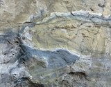
HOST ROCKS: Karst-collapse breccia. Breccia clasts

 as wide as 10 m across, consisting mainly of

sandstone (~90 percent) and siltstone (~10 percent),

occur in a matrix of quartz grains that is commonly

well-cemented with carbonate minerals. Minor

claystone and limestone clasts.


<!--}}end!kadov--><!--kadov_tag{{<implicit_p>}}-->

ASSOCIATED ROCKS: Unbrecciated flat-lying

 sandstone, siltstone, and limestone.

<!--begin!kadov{{-->


<!--}}end!kadov--><!--kadov_tag{{<implicit_p>}}-->

ORE MINERALOGY: Principal ore minerals:

uraninite±roscoelite+tyuyamunite*

+torbernite*+uranophane

*+zeunerite*+chalcopyrite+bornite*±chalcocite*±malachite*+azurite

*+brochantite *+volborthite+naumannite. Associated

base-metal minerals: ±sphalerite ±galena±bravoite±

rammelsbergite+stibnite +molybdenite+skutterudite.

An asterisk indicates sugergene origin. Pre-uraninite

mineral assemblages resemble those of Mississippi

Valley-type deposits. Unusual complexity of mineralogy

shown in appendix E.


<!--}}end!kadov--><!--kadov_tag{{<implicit_p>}}-->

GANGUE MINERALS:

Pyrite+marcasite+calcite+dolomite+barite+anhydrite±siderite

±hematite±limonite±goethite±pyrobitumen (see app.E).

<!--begin!kadov{{-->


<!--}}end!kadov--><!--kadov_tag{{<implicit_p>}}-->

TEXTURE AND MINERAL ZONING: Orebodies occur

 as discontinuous pods mainly in the core of the

breccia pipe but some are also found in the annular-

ring structure and may occupy as much as a 200-m

vertical interval (fig. 20). Mainly replacement and

sparse open-space filling. Pyrite/marcasite and base-

metal sulfides, locally associated with pyrobitumen,

form a discontinuous "massive sulfide cap" above the

uranium deposits in many pipes. Uranium, vanadium,

and copper roughly zoned within some deposits.

 ORE CONTROLS: Fractured, permeable rock within

breccia pipe. Nearly all primary ore confined to the

breccia pipe: rarely, a little uranium ore is reported in

relatively undisturbed beds outside the ring structure.

Vertically, most primary ore is below the Coconino

Sandstone and at the level of the Hermit Shale and the

Esplanade Sandstone of the Supai Group (fig. 20).


<!--}}end!kadov--><!--kadov_tag{{<implicit_p>}}-->

ISOTOPIC SIGNATURES: See Age Range above.

<!--begin!kadov{{-->


<!--}}end!kadov--><!--kadov_tag{{<implicit_p>}}-->

FLUID INCLUSIONS: Fluid-inclusion-filling

 temperatures of 80-173°C for ore-related sphalerite,

dolomite, and calcite. Salinities (in weight percent NaCl

equivalent) are for sphalerite, [= or >] 9, for dolomite,

[= or >] 17, and for calcite, [= or >] 4 (Wenrich, 1985;

Wenrich and Sutphin, 1988).


<!--begin!kadov{{-->


<!--}}end!kadov--><!--kadov_tag{{<implicit_p>}}-->

STRUCTURAL SETTING: All ore associated with solution-collapse breccia pipes.

<!--begin!kadov{{-->


<!--}}end!kadov--><!--kadov_tag{{<implicit_p>}}-->

ORE DEPOSIT GEOMETRY: Orebodies develop in

 annular-ring structures and in the core (fig. 20). At

Orphan Lode, orebodies in core range from 15 to 60

m in diameter and from 30 to 90 m high; annular-ring

orebodies are 5-20 m wide, and a few tens of meters

high, and extend variably part way around ring

circumference (Chenoweth, 1988).

<!--begin!kadov{{-->


<!--}}end!kadov--><!--kadov_tag{{<implicit_p>}}-->

ALTERATION: Characteristic bleaching by reduction

 (some extends locally outward into wall rocks as

much as 30 m); common carbonate recrystallization

and calcification, local dolomitization and kaolinization,

some weak silicification. Calcified rock extends outside

boundary shears, completely surrounding the Orphan

Lode pipe. Malachite, azurite, goethite, and other

secondary minerals on surface outcrops of eroded

pipes.

<!--begin!kadov{{-->


<!--}}end!kadov--><!--kadov_tag{{<implicit_p>}}-->

EFFECT OF WEATHERING: Leaching of U and

 enrichment of Cu and V, particularly in those pipes

deeply weathered. "Massive sulfide cap" apparently

prevented oxidation prior to erosion and exposure.


<!--}}end!kadov--><!--kadov_tag{{<implicit_p>}}-->

EFFECT OF METAMORPHISM: Not applicable.

<!--begin!kadov{{-->

 GEOCHEMICAL SIGNATURES: Enrichment of Ag,

As, Ba, Cd, Co, Cr, Cs, Cu, Hg, Mo, Ni, Pb, Sb, Se,

Sr, U, V, Y, Zn, Zr, and REE; indicator elements are

Ag, As, Co, Cu, Ni, Pb, and Zn (Wenrich, 1985).

<!--begin!kadov{{-->


<!--}}end!kadov--><!--kadov_tag{{<implicit_p>}}-->

GEOPHYSICAL SIGNATURES: Electrical conductivity

 and magnetic properties of the pipes are significantly

greater than for unbrecciated rocks; diagnostic

differences in conductivity shown by scalar

audiomagnetotelluric (AMT) and E-field telluric profile

data for one pipe (Flanigan and others, 1986). Ground

magnetometer surveys show subtle low magnetic

values over several pipes (Van Gosen and Wenrich,

1989).

<!--begin!kadov{{-->


<!--}}end!kadov--><!--kadov_tag{{<implicit_p>}}-->

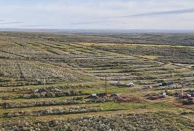
SPATIAL EXPLORATION GUIDES: Collapse features

 recognized by concentrically inward-dipping beds,

\circular concave topography, circular patches of

brecciated and (or) bleached or iron-stained rock

(related to "massive sulfide cap") and differences in

vegetation. In well-exposed areas of the Marble

Plateau, collapse breccia pipe densities are 0.11 pipes

per square kilometer. Marked tendency for pipes to

occur in clusters as small as 3 km2 in diameter. The

presence of one pipe indicates a high probability for

other pipes nearby.

<!--begin!kadov{{-->


<!--}}end!kadov--><!--kadov_tag{{<implicit_p>}}-->

OTHER EXPLORATION GUIDES: For a new area

\ outside of the Grand Canyon region, a thick (>15 m)

flat-lying, karst-forming limestone overlain by a thick

sequence of predominantly carbonate-cemented

sandstone and siltstone within a perpetually stable

cratonic environment and a post-pipe formation

volcanic source for uranium. Preexisting Mississippi

Valley-type Cu-Co-Ni-Pb-Zn sulfide-rich ore may be

required as a reductant for uranium deposition.


<!--}}end!kadov--><!--kadov_tag{{<implicit_p>}}-->

OVERBURDEN: Favorable area on Coconino Plateau

 (fig. 20): depths to mineralized portion of pipes are

150-600 m. Area exposed on Esplanade surface (fig.

20): depths are 0-120 m. Additional cover by basalt, 0-

100 m thick, around San Francisco and Mt. Floyd

volcanic fields. Quaternary and Tertiary sediments, 0-

50 m thick, cover a few areas.

<!--begin!kadov{{-->


<!--}}end!kadov--><!--kadov_tag{{<implicit_p>}}-->

OTHER: Tectonic stability required for preservation.

 "Massive sulfide cap" prevented and delayed oxidation

of some breccia pipe ores. Goethite possible

pathfinder mineral for recognition of concealed pipe.

absalman

دكتور / عبدالعاطي بدر سالمان جيولوجي استشاري، مصر [email protected]

  • Currently 30/5 Stars.
  • 1 2 3 4 5
10 تصويتات / 439 مشاهدة
نشرت فى 11 يناير 2011 بواسطة absalman


Not for commercial uses

This presentation includes the history of uranium production in Canada from its start at 1932 , 1950 to 1970 and from 1980 to the present

absalman

دكتور / عبدالعاطي بدر سالمان جيولوجي استشاري، مصر [email protected]

  • Currently 45/5 Stars.
  • 1 2 3 4 5
15 تصويتات / 402 مشاهدة
نشرت فى 7 يناير 2011 بواسطة absalman

URANIUM EXPLORATION


This presntation includes 3 main points as follows

Observe (fact)
Record (fact)
Interpret (fiction?)

Not for commercial uses

absalman

دكتور / عبدالعاطي بدر سالمان جيولوجي استشاري، مصر [email protected]

  • Currently 30/5 Stars.
  • 1 2 3 4 5
10 تصويتات / 415 مشاهدة
نشرت فى 5 يناير 2011 بواسطة absalman


Recent developments in uranium exploration in Canada


Best described as a uranium rush and we all know what happened in historical gold rushes

Not for commercial uses

absalman

دكتور / عبدالعاطي بدر سالمان جيولوجي استشاري، مصر [email protected]

  • Currently 31/5 Stars.
  • 1 2 3 4 5
11 تصويتات / 591 مشاهدة
نشرت فى 5 يناير 2011 بواسطة absalman

Not for commercial uses

Production start for Texan uranium

18 November 2010

Production has formally begun at Uranium Energy Corp's Palangana in-situ leach (ISL) uranium project, the first new ISL project to start up in the USA in five years. 

 
Palangana (Image: Uranium Energy Corp)

  The first of three separate development phases at the 2500 hectare site in South Texas is now fully complete with 30 injection wells and 15 production wells on line. After a testing phase involving the circulation of water through the wells, production officially commenced when gaseous oxygen and carbon dioxide was added to the circulating water to activate the mining process. The carbonate solution thus formed dissolves the uranium from the sandstone host, and the uranium-bearing solution is pumped to the surface, where it is concentrated on resin beads. The resin is then trucked the 160 kilometres to Uranium Energy's Hobson processing plant for processing.

Regular deliveries of uranium-loaded resin from Palangana to Hobson are expected to commence before the end of November. Work is also under way to bring the next two phases of the wellfield on line. All 45 wells in Phase II have been completed and are targeted to start production in the first quarter of 2011, while three rigs are working on completing a similar number of wells in Phase III, scheduled to come online in the second quarter of the year.

Uranium Energy purchased Palangana from Uranium One in December 2009 and completed the permitting process to bring the project into production using ISL in January 2010. Although the company is laying claim to Palangana as the first new US ISL project to start up in five years, the site did see uranium production using similar technology in the mid to late 1970s. The most recent technical report for the project, released in February 2010, shows measured and indicated resources totalling 1.057 million pounds U3O8 at an average grade of 0.135%, plus an additional 1.154 million pounds U3O8 of inferred resources at an average of 0.176%.

Uranium Energy has a portfolio of uranium exploration, development and mining sites across the south western USA in Texas, Wyoming, New Mexico, Arizona, Colorado and Utah including a large database of historic uranium exploration and development. The Goliad project, also in Texas, is now in the final stages of permitting. Company president and CEO Amir Adani said the company was "exceedingly proud" of Palangana's start-up. "This initial production is really just the first step in the company's regional strategy of greatly expanding resources and production in the re-emerging South Texas uranium belt, with the next project, the nearby Goliad ISR project, anticipated to join Palangana as a producing asset next year," he said.

Researched and written
by World Nuclear News

absalman

دكتور / عبدالعاطي بدر سالمان جيولوجي استشاري، مصر [email protected]

  • Currently 15/5 Stars.
  • 1 2 3 4 5
5 تصويتات / 422 مشاهدة
نشرت فى 3 يناير 2011 بواسطة absalman

مبارك يُعلن بدء مصر برنامجها النووي من "الضبعة" بلا شروط

الأحد 13 محرم 1432هـ - 19 ديسمبر 2010م

<!-- Include the related news block -->


أكد الرئيس المصري محمد حسني مبارك أن بلاده ماضية في مشروعها النووي السلمي، حاسماً اختيار منطقة "الضبعة" كموقع له، وقائلاً بلهجة عامية مازحة "ما تصدقوش الإشاعات".

وأشار مبارك إلى أن المشروع سيكون "بلا بشروط تتجاوز الالتزام بمعاهدة منع الانتشار النووي"، وأنه جزء من الأمن القومي لمصر.

وكانت وسائل الإعلام في القاهرة ومقالات عدد من الصحافيين تحدثت عن ضغوط من بعض رجال الأعمال المهيمنين على لجنة السياسات في الحزب الوطني الحاكم لاستغلال الضبعة على ساحل البحر الأبيض المتوسط في المشروعات الاستثمارية والسياحية، رغم أنها خصصت للبرنامج النووي، والبحث عن موقع بديل.

وقال مبارك: "سيظل أمن إمدادات الطاقة عنصراً أساسياً في بناء مستقبل الوطن وجزءاً لا يتجزأ من أمن مصر القومى". وأضاف أن البرنامج القومي للاستخدامات السلمية للطاقة النووية أصبح جزءاً من استراتيجية مصر الشاملة للطاقة وركناً مهماً من سياسات تنويع مصادرها وتأمين إمداداتها.

واستطرد في افتتاحه لمجلس الشعب الجديد، الأحد 19-12-2010: "إننا ماضون في تنفيذ هذا البرنامج دون تردد، متمسكين بحقوق مصر الثابتة وفق معاهدة منع الانتشار، ومتطلعين للعمل مع كل من يحقق مصالحنا بأعلى مستويات التكنولوجيا النووية والأمان النووي ودون شروط تتجاوز التزامنا بمقتضى هذه المعاهدة".

جدل سياسي حول "الضبعة"

الموقع المقترح للمحطة النووية في الضبعة

وكانت مصر أوقفت العمل ببرنامجها النووي عام 1986 بعد حادثة مفاعل "تشيرنوبل" في أوكرانيا.

وتقع الضبعة في محافظة مطروح على الساحل الشمالي لمصر وتبلغ مساحتها 60 كيلومتراً وتبعد كيلومترين عن الطريق الدولي، واكتسبت شهرتها السياسية من أنها تحتوي على أحد أنسب المواقع الصالحة لبناء مفاعل نووي، إلا أن وزير السياحة في جولة للمنطقة برفقة محافظ مطروح ووفد أجنبي أعلن عام 2004 أنه سوف يتم تحويلها لقرية سياحية، خصوصاً أنها تجاور الاستثمارات السياحية ومنتجعات الساحل الشمالي التي يسكنها الأثرياء ورجال الأعمال ونجوم المجتمع والطبقة التي توصف بالمخملية.

واعتبر الرأي العام وصحافيون وساسة هذا التصريح بمثابة نهاية للمشروع النووي المصري. وقالت الصحف المصرية إن بعض رجال الأعمال يمارسون ضغوطاً لاختيار موقع بديل لرغبتهم في إقامة قرى سياحية على الساحل الشمالي الغربي لمصر في موقع الضبعة.

وخصص موقع الضبعة لهيئة الطاقة الذرية بموجب قرار من رئاسة الجمهورية عام 1981. وقال وزير الكهرباء الأسبق مصطفى كمال صبري في خضم ذلك الجدل إن التخطيط للاستيلاء على موقع المفاعل النووي يعني إغلاق برنامج الملف النووي في مصر للأبد.

واتهم في تصريحات صحافية الولايات المتحدة وإسرائيل بالضغط على مصر للتخلص من هذا الموقع الوحيد الصالح لإنشاء مفاعلات نووية.

4 مفاعلات نووية

ويتسع الموقع لإنشاء 4 مفاعلات نووية، كما يقول خبراء متخصصون، أحدهم هو الدكتور فوزي حماد الرئيس الأسبق لهيئة الطاقة الذرية المصرية، وينتج طاقة كهربائية تقدر بأربعة آلاف ميغاوات.

وينتج السد العالي والمحطات المائية 4% فقط من احتياجات مصر من الطاقة الكهربائية.

وأعلن المدير العام للوكالة الدولية للطاقة الذرية يوكيا امانو في يونيو/حزيران الماضي أن الوكالة على استعداد لمساعدة مصر في برنامجها النووي السلمي.

وتمتلك مصر مفاعل أبحاث صغيراً في منطقة أنشاص (شرق القاهرة) وكانت قد وقعت على معاهدة منع الانتشار النووي عام 1981، لكنها ترفض التوقيع على بروتوكل إضافي يعزز صلاحيات الوكالة الدولية للطاقة الذرية في مجال التفتيش

absalman

دكتور / عبدالعاطي بدر سالمان جيولوجي استشاري، مصر [email protected]

  • Currently 75/5 Stars.
  • 1 2 3 4 5
25 تصويتات / 746 مشاهدة
نشرت فى 20 ديسمبر 2010 بواسطة absalman


مبارك يتابع تنفيذ البرنامج النووي المصري

كتب مرفت فهمي


العدد 1668 - الأحد الموافق - 12 ديسمبر 2010


ترأس الرئيس حسني مبارك ظهر أمس، اجتماعًا للمجلس الأعلي للاستخدامات السلمية للطاقة النووية ، بمقر رئاسة الجمهورية بمصر الجديدة.  

من جانبه صرح الدكتور حسن يونس وزير الكهرباء والطاقة، أن الاجتماع هو الثاني من نوعه بعد إعادة تشكيل المجلس برئاسة الرئيس حسني مبارك، وكان الرئيس مبارك قد حسم في الاجتماع السابق في أغسطس الماضي اختيار الضبعة كموقع لإقامة المحطات النووية. وأضاف يونس: إن هذا الموقع يمكنه استيعاب 4 محطات نووية، أشار إلي أنه تم خلال الاجتماع عرض الخطوات التي تم اتخاذها منذ انعقاد الاجتماع الأول في أغسطس، وأبرزها إعداد المواصفات التي سيتم علي أساسها طرح المناقصة العالمية في أواخر الشهر الحالي، أو أوائل الشهر المقبل. وأضاف: «أكد الرئيس مبارك خلال الاجتماع ضرورة عقد اجتماعات دورية مع المجلس خلال الفترة المقبلة للمتابعة بنفسه والتأكد من الخطوات التي يتم اتخاذها».

وأكد حسن يونس أن المناقصة التي تعتزم مصر طرحها خلال الأسابيع المقبلة، تتضمن إقامة وحدتين نوويتين لإنتاج الطاقة الكهربائية، بحيث يتم التعاقد علي الوحدة الأولي إلزاميًا، بينما يكون التعاقد علي الوحدة الثانية اختياريًا خلال عامين، وبنفس شروط الوحدة الأولي وأسعارها ويتضمن العقد مسئولية الجهة المنفذة عن تدريب الكوادر الفنية المصرية في التشغيل والصيانة. وقال يونس: «أكد الرئيس مبارك مجددًا ضرورة الاهتمام بتدريب الكوادر البشرية المصرية لأنها هي التي ستقوم بتشغيل وصيانة المحطات النووية المصرية »، وأشار إلي أن عملية إعداد الكوادر البشرية المصرية تتم علي قدم وساق في الداخل والخارج بمعاونة الدول ذات التكنولوجيا النووية ، مؤكدًا وجود تعاون في هذا الخصوص مع الولايات المتحدة وروسيا وفرنسا وكوريا الجنوبية والصين، فيما تم الانتهاء الأسبوع الماضي من تدريب 42 متدربًا مصريًا من هيئة المحطات النووية في روسيا، كاما قام الجانب الكوري بتدريب عدد من الكوادر المصرية في مجال الأمان النووية وأكد الوزير اهتمام جميع الدول والشركات المنتجة للطاقة النووية ، التي أبدت رغبتها في التنافس من أجل الفوز بالمناقصة العالمية لإنشاء المحطة النووية. وأضاف: وتم خلال الاجتماع مناقشة البدائل بشأن تمويل هذا المشروع، علي أن تتم المناقشة بشكل تفصيلي مع وزير المالية ليتم عرض النتائج التي سيتم التوصل إليها في هذا الصدد في الاجتماع المقبل للمجلس الأعلي للاستخدامات السلمية للطاقة النووية »، وأوضح يونس أن مصر ستسهم بجزء من هذا التمويل فيما أبدت الدول المنتجة للتكنولوجيا النووية استعدادًا للمساهمة في عملية التمويل.  وحول ما إذا كان البنك الدولي يمكن أن يكون أحد المساهمين في تمويل المشروع.. قال يونس إن البنك الدولي حتي الآن لا يمول مثل هذه المشروعات.

وحول التقدير المبدئي لإقامة المحطة النووية الواحدة.. قال وزير الكهرباء والطاقة: إن تكلفة إقامة المحطة النووية المحطة تبلغ نحو 4 مليارات دولار. وقال حسن يونس: إن من المقرر أن يبدأ تشغيل أول محطة في عام 2019 مع بدء تشغيل المحطة الرابعة بالضبعة بحلول عام 2025 .

وحول ما يتردد من تسريبات من الوكالة الدولية للطاقة الذرية بشأن   البرنامج النووي    المصري قال وزير الكهرباء والطاقة، إن كل ما يتم تسريبه في هذا الخصوص هو مجرد تسريبات لا تمس الواقع والعلاقات الجيدة التي تحكم مصر والوكالة، مؤكدًا أن هذه العلاقة الخصوص تدريب الكوادر المصرية من خلال خبراء الوكالة، ولذا فهو تعاون مستمر وسيستمر.  حول مشاركة الشركات المصرية في إقامة المحطات النووية المصرية قال حسن يونس: «لقد تم بالفعل تأهيل شركات الكهرباء المصرية للتعامل مع هذا المشروع، وذلك من خلال الجهة التي ستفوز بالمناقصة.

الرئيس: دربوا شباب مصر علي البرنامج النووي

قبل ساعات من إلقائه خطابا سياسيا مهما أمام أعضاء الهيئة البرلمانية للحزب الوطني بمجلس الشعب اليوم، قام الرئيس حسني مبارك بنشاط مكثف علي عدة محاور أمس بمقر رئاسة الجمهورية بمصر الجديدة، إذ ترأس اجتماعا للمجلس الأعلي للاستخدامات السلمية النووية


وتابع الرئيس في الاجتماع الثاني لمجلس الاستخدامات السلمية النووية خطوات تنفيذ البرنامج النووي السلمي لتوليد الطاقة بمصر بعد أن حسم في الاجتماع السابق أغسطس الماضي اختيار الضبعة موقعاً لإقامة المحطات النووية.  

وقال د. حسن يونس وزير الكهرباء: إن مناقصة المشروع منفتحة علي كل الدول المنتجة للتكنولوجيا النووية، مشيرا إلي اعتزام مصر طرح المناقصة خلال أسابيع لإقامة وحدتين نوويتين لإنتاج الطاقة الكهربائية وبتكلفة مبدئية نحو 4 مليارات دولار للمحطة الواحدة، معلنا أن المقرر بدء تشغيل أول محطة في عام 2019 وتشغيل المحطة الرابعة بالضبعة بحلول عام 2025 مشيراً إلي توجيه الرئيس مبارك بالاهتمام بتدريب الكوادر البشرية المصرية لانها من ستقوم بتشغيل وصيانة المحطات النووية المصرية.


absalman

دكتور / عبدالعاطي بدر سالمان جيولوجي استشاري، مصر [email protected]

  • Currently 30/5 Stars.
  • 1 2 3 4 5
10 تصويتات / 651 مشاهدة
نشرت فى 12 ديسمبر 2010 بواسطة absalman
نظيف: طرح مناقصة «المحطة النووية» قبل نهاية ديسمبر.. و يونس: إنشاء المحطة يستغرق ٧ سنوات

  كتب   منصور كامل    ١٠/ ١٢/ ٢٠١٠
 
نـظيف

عقد الدكتور أحمد نظيف، رئيس مجلس الوزراء، اجتماعاً لمناقشة برنامج إنشاء محطة توليد الكهرباء بالطاقة النووية المقرر إقامتها فى الضبعة، بحضور وزراء الكهرباء والمالية والتعاون الدولى والتنمية الاقتصادية، ورئيس هيئة المحطات النووية، الدكتور ياسين إبراهيم.

صرح الدكتور مجدى راضى، المتحدث الرسمى باسم مجلس الوزراء، بأن الدكتور نظيف أكد على السير بعملية الطرح الخاصة بالمناقصة، قبل نهاية ديسمبر الجارى، حيث تعكف وزارة الكهرباء بالتعاون مع المكتب الاستشارى على الانتهاء من الجوانب الفنية التى تضمنتها كراسة الطرح.

وأضاف راضى أن رئيس الوزراء أصدر توجيهاته بالتنسيق بين وزارتى الكهرباء والمالية، لإعداد الجانب المالى لعملية طرح المناقصة، وأشار إلى أنه تم خلال الاجتماع استعراض التكاليف المتوقعة لإنشاء المحطة النووية وبدائل التمويل المختلفة، حيث أكد الدكتور نظيف توافر التمويل اللازم لتنفيذ المحطة.

من جهته، أكد الدكتور حسن يونس، وزير الكهرباء والطاقة، استيفاء الجانب الفنى المتعلق بالمشروع، الذى سيمكن من إجراء الطرح قبل نهاية ديسمبر الجارى، مشيراً إلى أن عملية إنشاء المحطة ستستغرق سبع سنوات منذ بدء التشغيل.

كما تم خلال الاجتماع استعراض تجارب الدول المختلفة فى أساليب إنشاء المحطات النووية، ومن المقرر أن تعمل المحطة النووية بقدرة تتراوح ما بين ١٠٠ و١٥٠٠ ميجاوات.

absalman

دكتور / عبدالعاطي بدر سالمان جيولوجي استشاري، مصر [email protected]

  • Currently 30/5 Stars.
  • 1 2 3 4 5
10 تصويتات / 474 مشاهدة
نشرت فى 10 ديسمبر 2010 بواسطة absalman


* هذا الكتاب يشتمل علي عرض لإجابة عن سؤال: هل للطاقة النووية من  مستقبل؟ وهذا الكتاب من تأليف مؤيد يوسف وهو مترجم عن اللغة الإنجليزية وقام بترجمته د علاء عبد الحفيظ محمد. وهو يقع في 28 صفحة، والكتاب محمل بالكامل ضمن هذا الموقع.

* ليس للاستحدام التجاري 


absalman

دكتور / عبدالعاطي بدر سالمان جيولوجي استشاري، مصر [email protected]

  • Currently 30/5 Stars.
  • 1 2 3 4 5
10 تصويتات / 462 مشاهدة
نشرت فى 9 ديسمبر 2010 بواسطة absalman

Iran Discovers New Uranium Deposits

Tuesday, May 02, 2006

QOM, Iran —  Iran said Tuesday it had found uranium ore at three new sites in the center of the country, an announcement that appeared designed as a fresh challenge to the drive by the United States and allies to curb Tehran's nuclear program.

Iran already has considerable uranium resources available for its nuclear program, a fact that called into question the importance of the new discoveries — beyond their propaganda value. "We have got good news: the discovery of new economically viable deposits of uranium in central Iran," Mohammad Ghannadi, deputy chief for nuclear research and technology, told a conference. He said the deposits were found in the Khoshoomi region, Charchooleh and Narigan.

Iran's principal source of uranium is the Saghand mine in the center of the country, which has the capacity to produce 132,000 tons of ore per year. In Washington, State Department spokesman Sean McCormack said Iran's announcement showed "they are feeling increasingly uncomfortable" with their programs being reviewed by the U.N. Security Council. As a result, he said, "they are throwing up all sorts of chaff in the air right now to divert attention, to try to make threatening statements to the international community."

Ghannadi said Iran's enrichment of uranium was continuing, but he confirmed reports that a few of centrifuges at the enrichment facility in Natanz had crashed last month. "It's not a problem. They were repaired," Ghannadi said in this holy city south of Tehran. Iran announced April 11 that it had enriched uranium through cascades of centrifuges for the first time. The Security Council has demanded that Iran cease enrichment until all questions have been answered about extent of its nuclear program. Enriched uranium is used a fuel for nuclear power generators or in nuclear warheads. Last week, the International Atomic Energy Agency reported that Iran has flouted a Security Council deadline to suspend enrichment and had failed to provide answers to questions about its program.

Related Stories

Iran says its nuclear program is confined to generating power, but the United States and France accuse the country of secretly trying to build nuclear weapons. Representatives of the United States, Britain, France, Germany, Russia and China discussed the outlines of a Security Council resolution on Iran's nuclear program in Paris on Tuesday.

"I think what we will see unfold is that European governments will put forward following today's (Tuesday's) discussion some form of Chapter 7 resolution, and we'll discuss the form of it," U.S. Undersecretary of State Nicholas Burns said before the talks began. A resolution under the U.N. Charter's Chapter 7 makes any demands mandatory and allows for the use of sanctions and possibly force. Russia and China have said they are opposed to sanctions on Iran's nuclear program.

absalman

دكتور / عبدالعاطي بدر سالمان جيولوجي استشاري، مصر [email protected]

  • Currently 30/5 Stars.
  • 1 2 3 4 5
10 تصويتات / 544 مشاهدة

Uranium

Uranium is an extremely heavy metal, but instead of sinking into the Earth's core it is concentrated on the surface. Uranium is found almost exclusively in the Earth's continental crust, because its atoms don't fit in the crystal structure of the minerals of the mantle. Geochemists consider uranium one of the incompatible elements, more specifically a member of the large-ion lithophile element or LILE group. Its average abundance, over the whole continental crust, is a bit less than 3 parts per million.

 Uranium never occurs as bare metal; rather, it most often occurs in oxides as the minerals uraninite (UO2) or pitchblende (U3O8). In solution, uranium travels in molecular complexes with carbonate, sulfate and chloride as long as the chemical conditions are oxidizing. But under reducing conditions, uranium drops out of solution into mineral form. Carbon behaves the same way, as do several other elements.) This behavior is the key to uranium prospecting. Uranium deposits mainly occur in two geologic settings, a relatively cool one in sedimentary rocks and a hot one in granites.

Sedimentary Uranium Deposits

Because uranium moves in solution under oxidizing conditions and drops out under reducing conditions, it tends to gather where oxygen is absent, such as in black shales and other rocks rich in organic material. If oxidizing fluids move in, they mobilize the uranium and concentrate it along the front of the moving fluid. The famous roll-front uranium deposits of the Colorado Plateau are of this type, dating from the last few hundred million years. The uranium concentrations are not very high, but they are easy to mine and process.

The great uranium deposits of northern Saskatchewan, in Canada, are also of sedimentary origin but with a different scenario of much greater age. There an ancient continent was deeply eroded during the Early Proterozoic Era some 2 billion years ago, then was covered by deep layers of sedimentary rock. The unconformity between the eroded basement rocks and overlying sedimentary basin rocks is where chemical activity and fluid flows concentrated uranium into orebodies reaching 70 percent purity. Geological Survey Canada has an online report on its unconformity-associated uranium deposits with full details of this still-mysterious process.

Granitic Uranium Deposits

As large bodies of granite solidify, the trace amounts of uranium become concentrated in the last bits of fluid left. Especially at shallow levels, these may fracture and invade surrounding rocks with metal-bearing fluids, leaving veins of ore. More episodes of tectonic activity can concentrate these further, and the world's largest uranium deposit is one of these, a hematite breccia complex at Olympic Dam in South Australia.

Good specimens of uranium minerals are found in the final stage of granite solidification—the veins of large crystals and unusual minerals called pegmatites. There may be found cubic crystals of uraninite, black crusts of pitchblende and plates of uranium-phosphate minerals such as torbernite (Cu(UO2)(PO4)2·8–12H2O). Silver, vanadium and arsenic minerals are also common where uranium is found.

Pegmatite uranium is not worth mining today, because the ore deposits are small. But they are where the good mineral specimens are found.

The radioactivity of uranium affects the minerals around it. If you are examining a pegmatite, these signs of uranium include blackened fluorite, blue celestite, smoky quartz, golden beryl and red-stained feldspars. Also, chalcedony that contains uranium is intensely fluorescent with a yellow-green color.

Uranium in Commerce

Uranium is prized for its enormous energy content, which can be harnessed to generate heat in nuclear reactors or unleashed in nuclear explosives. The Nuclear Nonproliferation Treaty and other international agreements govern traffic in uranium to ensure that it is used only for civilian purposes. World trade in uranium amounts to more than 60,000 metric tons, all of it accounted for under international protocols. The largest producers of uranium are Canada, Australia and Kazakhstan.

The price of uranium has fluctuated with the fortunes of the nuclear power industry and the military needs of various countries. After the collapse of the Soviet Union, large stores of enriched uranium have been diluted and sold as nuclear fuel under the Highly Uranium Purchase Agreement, which kept prices low through the 1990s.

As of about 2005, however, prices have been climbing and prospectors are out in the field again for the first time in a generation. And with renewed attention on nuclear power as a zero-carbon energy source in the context of global warming, it is time to become familiar again with uranium.

absalman

دكتور / عبدالعاطي بدر سالمان جيولوجي استشاري، مصر [email protected]

  • Currently 30/5 Stars.
  • 1 2 3 4 5
10 تصويتات / 438 مشاهدة

* هذا الملف ليس للاستخدام التجاري

* يحتوي هذا الملف علي ملخصات البحوث التي ألقيت  بمؤتمر  U-2009 بمدينة كي استون بولاية كولورادو الأمريكية.

* تشمل هذا الملف مجموعة كبيرة من خلاصات البحوث القيمة في مجال استكشاف وانتاج وتعدين خامات اليورانيوم في دول عديدة، وهو يمثل نفعا ممتازا لراغبي المعرفة والاطلاع في هذا المجال.

* أرجو أن يكون فيه نفعا 

absalman

دكتور / عبدالعاطي بدر سالمان جيولوجي استشاري، مصر [email protected]

  • Currently 30/5 Stars.
  • 1 2 3 4 5
10 تصويتات / 307 مشاهدة
نشرت فى 13 نوفمبر 2010 بواسطة absalman

دكتور: عبدالعاطي بدر سالمان

absalman
Nuclear Education Geology & Development »

ابحث

تسجيل الدخول

عدد زيارات الموقع

1,352,951