Top 10 Gold Producing Countries of 2011

By Michelle Smith - Exclusive to Gold Investing News


Gold’s admirers are diverse, and so are the locations where it is mined. In 2011, over 1,800 tons of gold were produced in ten countries. These top producing nations, which span four continents, including both emerging and developed nations, are listed below.

China

Mine production: 355 tones

In addition to being a top gold consumer, China is also the leader of the world’s gold-producing nations, a title it took from South Africa in 2007. In 2011, China was the only country whose production exceeded 300 tones. Its mine output last year was ten tones more than in 2010, representing an almost 3 percent increase in production. China also ranks third in explored gold reserves.

Australia

Mine production: 270 tones

Australia’s production increased last year from the 261 tones reported for 2010. Most of the country’s yellow metal is extracted in the state of Western Australia, where the world-class Super Pit at Kalgoorlie is located. Once called the Golden Mile, and consisting of numerous mining operations, this landmark site was converted into Australia’s largest open-pit mine and is now owned by Newmont (NYSE:NEM,TSX:NMC) and Barrick Gold (NYSE:ABX,TSX:ABX).

United States

Mine production: 237 tones

Production of gold in the US rose from 231 tons in 2010. The vast majority of US gold are mined in the state of Nevada, home of the Carlin trend. Newmont has renowned operations in the region, including 14 open-pit mines and four underground mines that operate as an integrated unit employing various processing methods.

Russia

Mine production: 200 tones

Russia’s gold production increased 8 tons last year from the 192 tons mined in 2010. Though Russia is fourth among producers, the nation ranks second in explored reserves. The nation’s most prolific gold regions are Siberia and the Far East. Polyus Gold International (LSE: POLG), which claimed the title of top gold producer in Russia for 2011, operates mines in both areas.

South Africa

Mine production: 190 tones

Centered on the list is Africa’s largest gold-producing nation. Though South Africa is no longer the king of the producing nations, it continues to possess the most gold resources as well as the world’s largest deposits in Witswatersrand. From 2010 to 2011 gold production was virtually flat, with only a 1 ton increase reported, a 0.5 percent change.

Peru

Mine production: 150 tones

Peru is one of only two of the top ten gold-producing nations to experience declines in mined output in 2011. Production fell from 164 tons in 2010. Still, Peru is home to Minera Yanacocha, which is the largest gold producer in Latin America and has three active open pits.

Canada

Mine production: 110 tones

Like its southern neighbor, Canada saw its gold production increase last year, mining 110 tons compared to 91 tons in 2010. The majority of the nation’s gold comes from Ontario, which is the home of Goldcorp‘s (NYSE:GG,TSX:G) Red Lake gold mine. About half of the country’s annual gold production comes from Red Lake.

Ghana

Mine production: 100 tones

Ghana’s gold production rose from the 82 tones reported for 2010. Once known as the Gold Coast, this West African nation is the second-largest gold producer on the continent. The countries largest mine, Tarkwa, is operated by Gold Fields (NYSE:GFI).

Indonesia

Mine production: 100 tones

Indonesia is an archipelago of 17,508 islands in Southeast Asia. Despite the nation’s diverse geography, its gold resources are concentrated in a handful of mineral districts. One of the most notable is Grasberg, which hosts the world’s largest gold mine, also named Grasberg. Though it ranks equally with Ghana for production in 2011, that level of output is a decrease for Indonesia, which produced 120 tons in 2010.

Uzbekistan

Mine production: 90 tones

The world’s tenth-largest gold producer is Uzbekistan, a landlocked nation carved out of the former Soviet Union. The gold mining industry is dominated by state-owned Navoi Mining and Metallurgical Combinat, which is responsible for 80 percent of Uzbekistan’s gold production. Navoi Mining’s key asset is Muruntau, the world’s largest open-pit mine; its reserves are expected to last until about 2032.

absalman

دكتور / عبدالعاطي بدر سالمان جيولوجي استشاري، مصر [email protected]

  • Currently 0/5 Stars.
  • 1 2 3 4 5
0 تصويتات / 546 مشاهدة
نشرت فى 29 يونيو 2012 بواسطة absalman

Tectonic Activity of the World

By Andrew Alden, About.com Guide

(Image courtesy NASA)

This schematic map (click it to see it at full size) summarizes a great deal of information related to plate tectonics: areas of oceanic and continental crust, major faults and fault zones, active volcanic centers, names and boundaries of major tectonic platesspreading centers with their spreading rates, and transform zones. In addition, it shows other activity that may or may not be related to plate tectonics. The volcanoes of the Hawaiian Islands, for instance, make up a hotspot, and we don't have a final explanation for them. The scattered volcanoes in northern Africa are also a puzzle, but they are active and belong here too.

This is a snapshot of where we know tectonic activity is occurring now, that is, within the last million years. Notice that everything labeled on this map is a geologic entity, not a geographic one. No countries, no rivers, no mountain ranges, not even the oceans and continents are named on it. It is like an alternative, secret world. When experts get together to discuss plate tectonics, they are all familiar with this detail without having to look it up. But in fact, almost anywhere on the globe would have a much more complex map if you zoomed in on it.

للحصول علي الصورة بحجمها الطبيعي يرجي الرجوع إلي الرابط المشار إليه في المصدر


absalman

دكتور / عبدالعاطي بدر سالمان جيولوجي استشاري، مصر [email protected]

  • Currently 0/5 Stars.
  • 1 2 3 4 5
0 تصويتات / 454 مشاهدة

<!--<!--<!--[if gte mso 10]> <style> /* Style Definitions */ table.MsoNormalTable {mso-style-name:"Table Normal"; mso-tstyle-rowband-size:0; mso-tstyle-colband-size:0; mso-style-noshow:yes; mso-style-priority:99; mso-style-qformat:yes; mso-style-parent:""; mso-padding-alt:0cm 5.4pt 0cm 5.4pt; mso-para-margin:0cm; mso-para-margin-bottom:.0001pt; mso-pagination:widow-orphan; font-size:11.0pt; font-family:"Calibri","sans-serif"; mso-ascii-font-family:Calibri; mso-ascii-theme-font:minor-latin; mso-fareast-font-family:"Times New Roman"; mso-fareast-theme-font:minor-fareast; mso-hansi-font-family:Calibri; mso-hansi-theme-font:minor-latin; mso-bidi-font-family:Arial; mso-bidi-theme-font:minor-bidi;} </style> <![endif]-->

 COMPARATIVE STUDY ON VARIOUS SULPHIDE RICH MINERALIZATIONS, NORTH KORDOFAN STATE, SUDAN

Mohmed Ali, NW, El Sammani, Y., Abdel Rahman, EM.,

El Gizouli, MO, Sulieman, M., El Hafiz, M.

The geological Research Authority of the Sudan, P.O.Box 410Khartoum, Sudan.

This study is essentially based on comparison between geochemical data of various mineralizations located at Kordofan province. Each of these ore deposits characterized by elements that radically different than the other, that include lithology, degree of metamorphism, categorized genetic model known, geochronology, and definitive geological environment. Precisely, three VHMS Gammama, Mazroub and Fuga ore bodies, SEDEX sulphides at Abu Zaema, Quartz veins and quartzites at El Firga and Tinna close to Mazroub.

These ore bodies imply huge surface area from Mazroub to the east to Um Badir to the west. Despite these diversified and intricate geological environments that embrace all these ore bodies, and based on chemical grounds a common signature was found. The only conceivable model to this common signature is attributed to magma chamber conditions and the associated hydrothermal solutions. The slight differences in chemical signal may be attributed to magma hiatus and impetus as all these mineralizations are products of rejuvenation and multiple episodes hydrothermal activities was the main mechanism of formation. These properties that make all these ore bodies carry sulpides that usually associated with precious metals rendered them as highly exceptional geological phenomena and above all particularly highly enriched terrane of highly economic value. Mineral exploration in such terranes is imperative and most of the time fruitful.     

absalman

دكتور / عبدالعاطي بدر سالمان جيولوجي استشاري، مصر [email protected]

  • Currently 0/5 Stars.
  • 1 2 3 4 5
0 تصويتات / 398 مشاهدة

<!--<!--<!--

 Gold Mineralization Discovery in Umm Sagata- Qala En Nahal areas, Gadarif State - Eastern Sudan

Osman Abuagla Daffalla Hamed, Mohammed Azmi, El-Sheik Mohammed Abdel- Rahman, Salih Ali Salih

A low density stream sediments survey has been conducted in Umm Saqata-Qala En Nahal area, Gadarif State – Eastern Sudan. The aim of the study is to explore for gold and associated elements using a cost and time effective exploration method, in a low grade non explored Pan- African volcanosedimentary-greenstone belt. An orientational study has been conducted to determine the optimum fraction (grain size) for sampling in a rich Savana zone. About 12 samples have been collected from a mineralized locality and sieved for –125 µm and – 63 µm. Both of the fractions have been analyzed for gold using wet chemical technique with detection limit 2 ppb. Trace elements havebeen determined using Aque- regia - ICP technique.

Concentrations of gold mineralizatin and associated elements are typically found in the finest grain size fraction (silt and clay, -63 µm).

As it is the first time to conduct such survey in the study area a number of gold anomalies have been recorded. After selecting the right fraction the Umm Saqata- Qala En Nahal area has been fully geochemical surveyed at a density of 1 sample per 7 to 10 Km2.

absalman

دكتور / عبدالعاطي بدر سالمان جيولوجي استشاري، مصر [email protected]

  • Currently 0/5 Stars.
  • 1 2 3 4 5
0 تصويتات / 402 مشاهدة

<!--<!--<!--[if !mso]> <object classid="clsid:38481807-CA0E-42D2-BF39-B33AF135CC4D" id=ieooui> </object> <style> st1\:*{behavior:url(#ieooui) } </style> <![endif]--><!--[if gte mso 10]> <style> /* Style Definitions */ table.MsoNormalTable {mso-style-name:"Table Normal"; mso-tstyle-rowband-size:0; mso-tstyle-colband-size:0; mso-style-noshow:yes; mso-style-priority:99; mso-style-qformat:yes; mso-style-parent:""; mso-padding-alt:0cm 5.4pt 0cm 5.4pt; mso-para-margin:0cm; mso-para-margin-bottom:.0001pt; mso-pagination:widow-orphan; font-size:11.0pt; font-family:"Calibri","sans-serif"; mso-ascii-font-family:Calibri; mso-ascii-theme-font:minor-latin; mso-fareast-font-family:"Times New Roman"; mso-fareast-theme-font:minor-fareast; mso-hansi-font-family:Calibri; mso-hansi-theme-font:minor-latin; mso-bidi-font-family:Arial; mso-bidi-theme-font:minor-bidi;} </style> <![endif]-->

The Egyptian black sand deposits, beach economic mineral concentrates   and upgrading of low grade ilmenite concentrate

Prof. Mohamed Ismail Moustafa

Nuclear Materials Authority

The Egyptian black sand deposits are distributed along the northern coastal plain between Abu Qir to the west and Rafah to the east. These deposits are manily encountered in the beach sediments and the coastal sand dunes. The Egyptian black sand deposits contain strategic and economic heavy minerals which are needed for either nuclear industry or other metallurgical and engineering industries.

The essential economic minerals in these deposits are ilmenite, FeTiO3; magnetite,Fe3O4; garnet,(Fe,Mg,Mn,Ca)3Al2(SiO4)3; zircon, ZrSiO4; rutile, TiO2 and monazite (REEs- Ce,La,Nd,…..,Th)PO4. In addition ,some accessory minerals are also found: gold, Au; cassiterite, SnO2; xenotime, YPO4; thorite, ThSiO4; thorianite, ThO2; pitchblende, UO3; cinnabar HgS; chevkinite, REE4 Fe+² (Ti,Fe+³)2 Ti2Si4O22; copper; zinc; lead and platinum.

The average content of total economic minerals differs from place to other along the northern coast of Egypt. This content rarely exceeds 5% in the most upper meter of the beach deposits. Taking into consideration the first 20 meters of depth , it was concluded that the top meter includes 40-50% of the average total economic minerals content, the top 5 meters include 70-80% and the top 10 meters include 85-95% of the average total economic minerals content. Ilmenite is the most common economic mineral, it alone represents about 50% of the total economic minerals content, while monazite has the lowest content, it represents 0.01% in average. The coastal sand dunes may contain average total economic minerals content higher than that of the beach sediments.

In the surfacial naturally high concentrated black sand deposits, the average total economic minerals content may attains more than 90%. Such surfacial sediments are represented by zones of erosion due to action of marine currents and waves.

Using both of wet gravity concentration, low-high intensity magnetic separation and high-tension electrostatic separation techniques, each of the individual economic minerals can be obtained in a corresponding high- purity mineral concentrate with accepted grade and recovery. The physical and chemical specifications for most of the obtained Egyptian economic mineral concentrates are suitable for local and foreign markets.

During the last 10 years definite amounts of the individual economic mineral concentrates were produced from the Egyptian black sand deposits using a project constructed by Nuclear Materials Authority. The following amounts of economic mineral concentrates were produced: leucoxene, 18 ton; rutile, 100 ton; zircon, 1000 ton; magnetite, 2600 ton and ilmenite, 4000 ton. Two thirds the produced amount of ilmenite were imported to China and others.

Ilmenite is the main economic mineral in the Egyptian black sand deposits. It is characteristic by low content of TiO2 and high content of Cr2O3. The contents of these two oxides may affect negatively on the marketing of ilmenite concentrates. Several processes for ilmenite treatments were suggested to improve its marketable specifications. As for example smelting process to produce high titania rich slag and pig iron and acid chemical treatments to produce synthetic rutile or TiO2 pigment.  

absalman

دكتور / عبدالعاطي بدر سالمان جيولوجي استشاري، مصر [email protected]

  • Currently 0/5 Stars.
  • 1 2 3 4 5
0 تصويتات / 361 مشاهدة
نشرت فى 8 مارس 2012 بواسطة absalman

<!--<!--<!--[if !mso]> <object classid="clsid:38481807-CA0E-42D2-BF39-B33AF135CC4D" id=ieooui> </object> <style> st1\:*{behavior:url(#ieooui) } </style> <![endif]--><!--[if gte mso 10]> <style> /* Style Definitions */ table.MsoNormalTable {mso-style-name:"Table Normal"; mso-tstyle-rowband-size:0; mso-tstyle-colband-size:0; mso-style-noshow:yes; mso-style-priority:99; mso-style-qformat:yes; mso-style-parent:""; mso-padding-alt:0cm 5.4pt 0cm 5.4pt; mso-para-margin:0cm; mso-para-margin-bottom:.0001pt; mso-pagination:widow-orphan; font-size:11.0pt; font-family:"Calibri","sans-serif"; mso-ascii-font-family:Calibri; mso-ascii-theme-font:minor-latin; mso-fareast-font-family:"Times New Roman"; mso-fareast-theme-font:minor-fareast; mso-hansi-font-family:Calibri; mso-hansi-theme-font:minor-latin; mso-bidi-font-family:Arial; mso-bidi-theme-font:minor-bidi;} </style> <![endif]-->

The Egyptian black sand deposits, beach economic mineral concentrates   and upgrading of low grade ilmenite concentrate

Prof. Mohamed Ismail Moustafa

Nuclear Materials Authority

The Egyptian black sand deposits are distributed along the northern coastal plain between Abu Qir to the west and Rafah to the east. These deposits are manily encountered in the beach sediments and the coastal sand dunes. The Egyptian black sand deposits contain strategic and economic heavy minerals which are needed for either nuclear industry or other metallurgical and engineering industries.

The essential economic minerals in these deposits are ilmenite, FeTiO3; magnetite,Fe3O4; garnet,(Fe,Mg,Mn,Ca)3Al2(SiO4)3; zircon, ZrSiO4; rutile, TiO2 and monazite (REEs- Ce,La,Nd,…..,Th)PO4. In addition ,some accessory minerals are also found: gold, Au; cassiterite, SnO2; xenotime, YPO4; thorite, ThSiO4; thorianite, ThO2; pitchblende, UO3; cinnabar HgS; chevkinite, REE4 Fe+² (Ti,Fe+³)2 Ti2Si4O22; copper; zinc; lead and platinum.

The average content of total economic minerals differs from place to other along the northern coast of Egypt. This content rarely exceeds 5% in the most upper meter of the beach deposits. Taking into consideration the first 20 meters of depth , it was concluded that the top meter includes 40-50% of the average total economic minerals content, the top 5 meters include 70-80% and the top 10 meters include 85-95% of the average total economic minerals content. Ilmenite is the most common economic mineral, it alone represents about 50% of the total economic minerals content, while monazite has the lowest content, it represents 0.01% in average. The coastal sand dunes may contain average total economic minerals content higher than that of the beach sediments.

In the surfacial naturally high concentrated black sand deposits, the average total economic minerals content may attains more than 90%. Such surfacial sediments are represented by zones of erosion due to action of marine currents and waves.

Using both of wet gravity concentration, low-high intensity magnetic separation and high-tension electrostatic separation techniques, each of the individual economic minerals can be obtained in a corresponding high- purity mineral concentrate with accepted grade and recovery. The physical and chemical specifications for most of the obtained Egyptian economic mineral concentrates are suitable for local and foreign markets.

During the last 10 years definite amounts of the individual economic mineral concentrates were produced from the Egyptian black sand deposits using a project constructed by Nuclear Materials Authority. The following amounts of economic mineral concentrates were produced: leucoxene, 18 ton; rutile, 100 ton; zircon, 1000 ton; magnetite, 2600 ton and ilmenite, 4000 ton. Two thirds the produced amount of ilmenite were imported to China and others.

Ilmenite is the main economic mineral in the Egyptian black sand deposits. It is characteristic by low content of TiO2 and high content of Cr2O3. The contents of these two oxides may affect negatively on the marketing of ilmenite concentrates. Several processes for ilmenite treatments were suggested to improve its marketable specifications. As for example smelting process to produce high titania rich slag and pig iron and acid chemical treatments to produce synthetic rutile or TiO2 pigment.  

absalman

دكتور / عبدالعاطي بدر سالمان جيولوجي استشاري، مصر [email protected]

  • Currently 0/5 Stars.
  • 1 2 3 4 5
0 تصويتات / 1219 مشاهدة
نشرت فى 8 مارس 2012 بواسطة absalman
absalman

دكتور / عبدالعاطي بدر سالمان جيولوجي استشاري، مصر [email protected]

  • Currently 0/5 Stars.
  • 1 2 3 4 5
0 تصويتات / 425 مشاهدة

TOTAL PETROLEUM SYSTEMS AND ASSESSMENT UNITS

Middle East—Eastern Arabian Subcontinent

Overview
An estimated two-thirds of the world’s ultimately recoverable oil is in the Arabian  -
Persian Gulf Region and in the Greater Arabian and Greater Oman Basins
(Beydoun, 1991; Cole Carrigan, and others, 1994; Cole, Abu-Ali and others, 1994;
Alsharhan and Nairn, 1997). Most oil is generated and produced from Jurassic
carbonates; however, Cretaceous, Paleozoic, and Infracambrian petroleum systems
account for production in numerous giant oil fields in reservoirs of equivalent age.
This area of the Middle East is rich in petroleum because it comprised an areally
extensive depositional platform along a pre-Mesozoic passive margin of Gondwana.
Subsequent development of intraplatform basins, extensive source-rock deposition
within these basins, and multiple tectonic stages of compression and extension,
produced large subtle structural closures coincident with peak oil generation and
migration. Moreover, the large resource base was secured by efficient horizontal
hydrocarbon migration into traps underlying thick, regionally extensive evaporite
seals.
Four, overlapping mega-TPS are identified in eight of the priority provinces located
on the eastern half of the Arabian Peninsula. This locale encompasses the area east
of the Arabian Shield, along the Arabian-Persian Gulf, eastward to the Zagros Fold
Belt and Oman Mountains and in eastern Saudi Arabia, Kuwait, Qatar, United Arab
Emirates, Oman, Yemen, and Iran. Combined, this region comprises the Greater Arabian and Greater Oman Basins.

* The article is attached

absalman

دكتور / عبدالعاطي بدر سالمان جيولوجي استشاري، مصر [email protected]

  • Currently 0/5 Stars.
  • 1 2 3 4 5
0 تصويتات / 369 مشاهدة
نشرت فى 9 ديسمبر 2011 بواسطة absalman

اغرب عشر عجائب جيولوجية في العالم 

1- الموجة 

The Wave (between Arizona and Utah - USA

صخور حمراء مثيرة على الحدود بين ولايتي أريزونا ويوتاه الموج يبلغ عمره 190 مليون عاما
و هو عباوة عن كثبان رملية تحولت الى صخر.

******************************************

2- كانيون الظباءAntelope Canyon (Arizona - USA


لأكثر زيارة و تصويرا في جنوب غرب أمريكا, Antelope Canyon،يقع على أرض نافاجو بالقرب من الصفحة بولاية أريزونا.
ويشمل مغارتين منفصلتين:العليا "The Crack"و السفلى "The Corkscrew".
الاسم الذي يطلقه النافاجو على''The Crack''هو Tse' bighaniliniوالذي يعني" المكان الذي يمر عبر الصخور والمياه ".
و على "The Corkscrew" هو Hasdestwazi ، أو "دوامة صخرة الأقواس

"************************************************* 

3الهول الازرق الكبيرGreat Blue Hole (Belize


جزء من نظام المرجانية المنارة ، الأزرق الكبير يتواجد على ما يقرب من 60 ميلا قبالة البر من مدينة  بليز.
كبير ، وفتحة دائرية تقريبا يبلغ طول قطره ربع ميل (0.4 كم) عبر انه واحد من أكثر مواقع  الغوص المذهلة لا يمكن العثور على مثله في أي مكان على وجه الأرض.
داخل هذا الثقب يصل العمق الى 480 قدم (145 م) تعطي المياه العميقة اللون الأزرق لذا تسمى مثيلاتها ب "blue holes."

*************************************************************

4- مغارة الكريستال 

Crystal Cave of the Giants, Mexico


وجدت في عمق الألغام في جنوب لتشيواوا بالمكسيك ، وكانت هذه البلورات التي  تشكلت طبيعيا تماما في كهف مغلق في الأساس.
تشكيلات مذهلة من البلورات الشامخة شموخ اشجار الصنوبر ، فهي شفافة و كالذهب والفضة في اللون والعديد من أشكاله وألوانه لا يصدق.
اكتشف الحجر الجيري داخل نفس الجهة التي تستضيف الفضة والزنك والرصاص الخام
و لم يسمح للشركات بالاستغلال.

***********************************************

5- العين فيالصحراء ( موريتانيا )

Eye of the Sahara : Mauritania


هذا مذهل اراض في موريتانيا فى الجزء الجنوبى الغربى من الصحراء مع قطرها الواسع 30 ميلا يمكن رؤيتها من الفضاء.
اسمها كذلكRichat او -- عين الصحراء -- تشكيل كان يعتقد أن سببه نيزك لكن الجيولوجيين الآن يعتقدون أنه نتاج رفع والتعرية.
الا ان سبب شكلها الدائري لا يزال لغزا !!! ****************************************************

6- بحيرة الكهف الزرقاء ( البرازيل )Blue Lake Cave: Brazil


ماتو غروسو دو سول في البرازيل في (وخاصة من مدينةالبينيت الهادئة) يضم العديد من البحيرات الرائعة تحت الارض
ولعل الشهيرة في العالم هي "Gruta do Lago Azul” (بحيرة الكهف الأزرق)معجزة طبيعية مكونة من الحليمات العليا ،
والصواعد الكلسية الشيقة الكبيرة والرائعة الجمال هذه البحيرة شيء رائع.
بالكهف مجموعة  من التشكلات الجيولوجية لكن جمال المياه اروع.

************************************************

7- جسر العمالقة Giants Causeway: Ireland


في كبيرةعلى الساحل الشمالي الشرقي من ايرلندا الشمالية تتناثر أعمدة البازلت المتشابكة ،
جسر العمالقة هو نتيجة انفجار بركاني قديم. ، ومعظم الأعمدة مسدس الأضلاع ، وإن كانت هناك أيضا بعض أربعة ، خمسة ، سبعة وثمانية من الجانبين.أطول الاعمدة يبلغ طوله نحو 12 مترا (36 قدم)

******************************************************

8- بوابة الجحيم Hell Gate :Uzbekistan

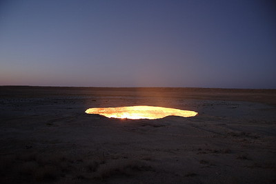
اطلق عليه  السكان المحليين باب جهنم ، وهذا المكان في أوزبكستان ويقع بالقرب من بلدة دارفاز.
 عندما كان علماء الجيولوجيا والتنقيب عن الغاز ، وقبل 35 عاما ، فجأة وجدوا كهف تحت الأرض التي  كانت كبيرة جدا ،
لم يتجرأ احد على النزول هناك لأن كهف كان مملوءا بالغاز ، حتى أشعل ذلك أنه لا يمكن أن يأتي الغاز السام من الفتحة ، ومنذ ذلك الحين ، و هو يحرق.
لا أحد يعرف كم طن من الغاز ممتازة وقد احرق كل هذه السنوات ولكن  يبدو أن لا نهاية.

*******************************************************

9- موجة روك Wave Rock (Australia)


Wave Rockتشكلات صخرية طبيعية واقعة في غرب أستراليا. يستمد اسمه من حقيقة أنه على شكل تكسرالامواج بالمحيطات.
ويغطي عدة هكتارات و"الموجة" جزء من الصخرة بارتفاع نحو 15 مترا وطول حوالي 110 مترا.
واحد من جوانب الموج الصخرة ونادرا ما يظهر في الصور هو الإبقاء على الجدار حتى منتصف الصخورو هذاما يسمح بجمع مياه الأمطار في سد.
وكان بناؤه في عام 1951 من قبل وزارة الأشغال العامة ، وهذه الجدران مماثلة عام على العديد من الصخور

******************************************************

10 - شوكولاتة هيلز Chocolate Hills: Philippines


تقع في بوهول والفلبين و تمتد على مساحة أكثر من 50 كيلومترا مربعا (20 ميل مربع) وتتألف من نحو 1.268 تماما مخروطية تلال عن نفس الحجم ،
هذه التشكلات الجيولوجية غير عادية ، ودعا شوكولا وهناك عدد من الافتراضات فيما يتعلق بتشكيل التلال.
تجوية بسيطة من الحجر الجيري ، نشاط بركاني في المحيط ، الا ان نظرية رفع مستوى قاع البحر أكثر حداثة من الناحية النظرية على النحو  الذي يؤكد أن بركان نشط قديم دمر ذاتيا ،
مخلفا رماداو كتلا ضخمة من الحجر التي كانت مغطاة الحجر الجيري ، والتي ارتفعت في وقت لاحق من قاع المحيطات.

absalman

دكتور / عبدالعاطي بدر سالمان جيولوجي استشاري، مصر [email protected]

  • Currently 41/5 Stars.
  • 1 2 3 4 5
13 تصويتات / 1081 مشاهدة
نشرت فى 17 أكتوبر 2011 بواسطة absalman

<!--<!--<!--

Introduction to the Geology of Ethiopia

             The Orogenic belts of the Arabian Nubian Shield (ANS) and the Mozambique Belt (MB) are believed to be more prominent in outcrop in Ethiopia than in any other country of the Horn of Africa (Kazmin, 1972; Berhe, 1990). However, the rocks belonging to these orogenic belts are only exposed in a few areas, which have not been affected by Cenozoic volcanism and rifting, and where the Phanerozoic cover rocks have been eroded away (Tefera et al., 1996)

Generally, little work was done on the geology of Ethiopia until the early 1970s. Some more generalized ideas about the Geology of Ethiopia were derived from limited mapping and prospecting in various regions of the country (eg., Blanford, 1870; Dainelli, 1943). Dainelli (1943) translated this work from the Italian in to the English language and compiled the Geology of Ethiopia with limited modification, specifically for the rift valley volcanics and tectonics. Subsequently, the work by Kazmin (1972), Kazmin et al. (1978) and Merla et al. (1973) extended the previous studies of the geology of Ethiopia and East Africa.

            Gilboy (1970) and Chater (1971) were first to propose a three-fold classification of the Precambrian basement rocks of southern Ethiopiain to Lower, Middle and Upper Groups. Each of these groups is characterized by different lithology and structure, with an overall decrease in metamorphic grade from the Lower to the Upper Group. Kazmin   (1972) redefined these groups as the Lower, Middle and Upper Complexes, comprising Archean, Early Proterozoic, and Late Proterozoic lithostratigraphic sequences, respectively. The same author compiled the Geology of Ethiopia in the form of a 1:2,000,000 scale map, with an accompanying report (Kazmin, 1972).

            In 1968, the Ethiopian Institute of Geological Surveys (EIGS) was established with the aim to conduct systematic and integrated geological mapping and mineral exploration. Since then, a large amount of mapping and exploration activities has been carried out in different parts of the country (e.g., Omo River Project, 1975; Kozyrev et al., 1985; Moore et al., 1987; Woldegebriel et al., 1994; Hambissa et al., 1997; Tadesse, 1997; Tadesse and Melaku, 1998). At present, about 30 % of the country has been mapped at the 1:250,000 scale. The cumulative regional mapping shows that the country is covered by about 18% Proterozoic

المقال بالكامل في الملف المرفق

absalman

دكتور / عبدالعاطي بدر سالمان جيولوجي استشاري، مصر [email protected]

  • Currently 35/5 Stars.
  • 1 2 3 4 5
11 تصويتات / 537 مشاهدة

MONTMORILLONITE/ILLITE STABILITY DIAGRAMS

ROBERT M. GARRELSDepartment of Marine Science, University of South Florida140 7th Avenue South, St. Petersburg, Florida 33701

Abstract- Chemical activity diagraoas , prepared to illustrate the properties expected if mixed-layer montmorillonite/ illite is regarded as a solid solution, are compared to those derived from a treatment of these materials as a mixture of two phases. If the system is a solid solution, the coexisting aqueous solution should range from higher dissolved silica contents in the presence of kaolinite and a montmorillonite end member to lower dissolved silica in the presence of kaolinite and an illitic end member. Silica concentration
in the aqueous solution might vary by a factor of as much as six. If the system is two phase, the silica  content of a solution in equilibrium with kaolinite and both phases would be fixed at a given T and P, as would a solution equilibrated with both phases and K-feldspar. In the absence of a third phase, silica in equilibrium with both phases should be nearly constant, but increase with increasing ratio of K+/H + in solution. Available data on coexisting aqueous solutions apparently are more nearly consistent with
two phases than with a solid solution.

absalman

دكتور / عبدالعاطي بدر سالمان جيولوجي استشاري، مصر [email protected]

  • Currently 30/5 Stars.
  • 1 2 3 4 5
10 تصويتات / 463 مشاهدة
نشرت فى 6 أغسطس 2011 بواسطة absalman

Upper Cretaceous (Campanian) phosphorites in Jordan: implications for the formation of a south Tethyan phosphorite giant


Peir K. Pufahla,*, Kurt A. Grimma, Abdulkader M. Abedb, Rushdi M.Y. Sadaqahb

Abstract
A record of sedimentary, authigenic, and biological processes are preserved within the Upper Cretaceous (Campanian)  Alhisa Phosphorite Formation (AP) in central and northern Jordan. The AP formed near the eastern extremity of the south Tethyan Phosphorite Province (STPP), a carbonate-dominated Upper Cretaceous to Eocene ‘‘phosphorite giant’’ that extends from Colombia, North Africa to the Middle East. Multidisciplinary research of the AP and associated cherts, chalks, and oyster buildups indicate that phosphatic strata formed on a highly productive, storm-dominated, east–west trending epeiric platform along the south Tethyan margin. The onset of phosphogenesis and the accumulation of economic phosphorite coincided with a rise in relative sea level that onlapped peritidal carbonates of the Ajlun Group.
Pristine phosphates are associated with well-developed micrite concretionary horizons and contain abundant non-keeled spiral planktic foraminifera and a low diversity benthic assemblage of Buliminacean foraminifera, suggesting that pristine phosphates are a condensed facies and phosphogenesis was stimulated by the effects of a highly productive surface ocean and the suboxic diagenesis of sedimentary organic matter. The bulk sediment composition and absence of Fe-bearing authigenic phases such as glauconite, pyrite (including pyrite molds), siderite, and goethite within pristine phosphates suggests that deposition and authigenesis occurred under conditions of detrital starvation and that ‘‘iron-pumping’’ played a minimal role in phosphogenesis. Authigenic precipitation of phosphate occurred in a broad array of sedimentary environments—herein termed a ‘‘phosphorite nursery’’—that spanned the entire platform. This is a non-uniformitarian phenomenon reflecting precipitation of sedimentary apatite across a wide depositional spectrum in a variety of depositional settings, wherever the conditions were suitable for phosphogenesis. Sedimentologic data indicate that pristine phosphates were concentrated into phosphatic grainstones through storm wave winnowing, and storm-generated, shelf-parallel geostrophic currents. Economic phosphorites formed through the amalgamation of storm-induced event beds. Stratigraphic packaging of phosphatic strata indicates that temporal variations in storm frequency were a prerequisite for the formation of economic phosphorite. Syndepositional phosphogenesis, reworking, and amalgamation to form phosphorites contrasts sharply with the principles of ‘‘Baturin Cycling’’. A transgressive systems tract coupled with high surface productivity created detritally starved settings favourable for phosphogenesis; storm reworking of pristine
 

absalman

دكتور / عبدالعاطي بدر سالمان جيولوجي استشاري، مصر [email protected]

  • Currently 20/5 Stars.
  • 1 2 3 4 5
7 تصويتات / 565 مشاهدة
نشرت فى 25 مارس 2011 بواسطة absalman

Finite element modeling of the pull-apart formation: implication for tectonics of Bengo Co pull-apart basin, southern Tibet

Ganesh Raj Joshi, Daigoro Hayashi

  NS >> Vol.2 No.6, June 2010

Abstract

The tectonic deformation and state of stress are significant parameters to understand the active structure, seismic phenomenon and overall ongoing geodynamic condition of any region. In this paper, we have examined the state of stress and crustal deformation during the formation of the Beng Co pull-apart basins produced by an enéchelon strike-slip fault systems using 2D Finite Element Modelling (FEM) under plane stress condition. The numerical modelling technique used for the experiments is based on FEM which enables us to analyze the static behavior of a real and continues structures. We have used three sets of models to explore how the geometry of model (fault overlap and pre-existing weak shear zone) and applied boundary conditions (pure strike-slip, transpressional and transtensional) influence the development of state of stress and deformation during the formation of pull-apart basins. Modelling results presented here are based on five parameters: 1) distribution, orienttation, and magnitude of maximum (σH max) and minimum (σH max) horizontal compressive stress 2) magnitude and orientation of displacement vectors 3) distribution and concentration of strain 4) distribution of fault type and 5) distribution and concentration of maximum shear stress (σH max) contours. The modelling results demonstrate that the deformation pattern of the en-échelon strike-slip pull-apart formation is mainly dependent on the applied boundary conditions and amount of overlap between two master strike-slip faults. When the amount of overlap of the two master strike-slip faults increases, the surface deformation gets wider and longer but when the overlap between two master strike-slip faults is zero, block rotation observed significantly, and only narrow and small surface deform ation obtained. These results imply that overlap between two master strike-slip faults is a significant factor in controlling the shape, size and morphology of the pull-apart basin formation. Results of numerical modelling further show that the pattern of the distribution of maximum shear stress (τmax) contours are prominently depend on the amount of overlap between two master strike-slip faults and applied boundary conditions. In case of more overlap between two masters strike-slip faults, τ max mainly concentrated at two corners of the master faults and that reduces and finally reaches zero at the centre of the pull-apart basin, whereas in case of no overlap, τmax largely concentrated at two corners and tips of the master strike-slip faults. These results imply that the distribution and concentration of the maximum shear stress is mainly governed by amount of overlap between the master strike-slip faults in the en-échelon pull-apart formation. Numerical results further highlight that the distribution patterns of the displacement vectors are mostly dependent on the amount of overlap and applied boundary conditions in the en-échelon pull-apart formation.

absalman

دكتور / عبدالعاطي بدر سالمان جيولوجي استشاري، مصر [email protected]

  • Currently 15/5 Stars.
  • 1 2 3 4 5
5 تصويتات / 516 مشاهدة

Morocco Field Trip Guide

GEOLOGY OF MOROCCO
The geology of Morocco is extremely varied, and preserves an almost complete geological record from the Archaean to the Recent. The Pre-Cambrian and Palaeozoic geology records a number of orogenic events, and the gradual movement of the African Plate from a position near the South Pole in the Ordovician to the tropics by the Carboniferous. This terminated in a Carboniferous-Permian phase of deformation very similar to the Hercynian/Variscan deformation of Europe (although on a separate continent at the time). In the period between the Permian breakup of Pangaea and the Alpine deformation of the Tertiary, Morocco was on the southern margin of the Tethys Ocean and hence separated from Europe by a narrow but significant ocean. During the Triassic and Early Jurassic, there was North-South extension forming sedimentary basins within which were deposited the rocks that now form the Atlas Mountains. At the same time, there was very major East-West extension related to Atlantic rifting in the area that is now offshore to the West of Morocco, and by the Jurassic this had allowed oceanic crust development along what would become the North Atlantic. The partial closure of Tethys (leaving the Mediterranean) during the Tertiary caused a major phase of mountain building, and resulted in the deformation within the Rif and Atlas ranges. Quaternary climate changes resulted in a fluctuation between very arid and quite humid conditions; at present the Atlas range marks the northern limit of the Sahara, and desert erosional and sedimentological processes dominate much of inland Morocco.
Moroccan geological regions
Morocco can be divided up into a number of different geological regions, each characterised by a different geological history. On this field class we will be crossing the western and eastern Meseta, Atlas Mountains and eastern anti-Atlas

absalman

دكتور / عبدالعاطي بدر سالمان جيولوجي استشاري، مصر [email protected]

  • Currently 33/5 Stars.
  • 1 2 3 4 5
12 تصويتات / 731 مشاهدة
نشرت فى 27 يناير 2011 بواسطة absalman


MAJOR CONCEPTS

1. Divergent plate boundaries are zones where  lithospheric plates move apart from one another.They are characterized by tensional stresses that typically produce long rift zones, normal faults, and basaltic volcanism.


2. An oceanic ridge marks divergent plate boundaries in the ocean basins. It is a broad, fractured swell with a total length of about 70,000 km. Basaltic volcanism and shallow earthquakes are concentrated along the rift zone at the ridge crest.

3. The ridge’s characteristics depend upon the spreading rate. As oceanic lithosphere moves away from the ridge, it cools, becomes thicker and denser, and subsides

.
4. Oceanic crust is generated at divergent plate boundaries and is composed of four major layers: (a) deep marine sediment, (b) pillow basalts, (c) sheeted dikes, and (d) gabbro. Below the crust lies a zone of sheared peridotite in the upper mantle.

5. At divergent plate boundaries, basaltic magmatism results from decompression melting of the mantle. The magma then collects into elongate chambers beneath the ridge, and some is intruded as dikes or extruded along the rift zone.


6. Seawater is heated as it circulates through the hot crust and causes extensive metamorphism. Locally, the hydrothermal fluids produce hot springs on the seafloor.

7. Continental rifting occurs where divergent plate margins develop within continents. The East African Rift, the Red Sea, and the Atlantic Ocean illustrate the progression from continental rifting to seafloor formation.


8. Continental rifting creates new continental margins marked by normal faults and volcanic rocks interlayered with thick sequences of continental sedimentary rocks. As the continental margin subsides, it is gradually buried beneath a thick layer of shallow-marine sediments

absalman

دكتور / عبدالعاطي بدر سالمان جيولوجي استشاري، مصر [email protected]

  • Currently 30/5 Stars.
  • 1 2 3 4 5
10 تصويتات / 622 مشاهدة


 Towards a new potential field theory of fractal objects

Mostafa E. Nostafa , NMA, Cairo, Egypt


Abstract

The Potential Field Anomaly (PFA) data of the self similar Fractal Objects (FOs) include gravity and magnetic fields and potentials along with the related derivatives. These elements are calculated on grids due to buried FOs at different fractal orders. The objects have variable physical property distributions; while in magnetic, the orientation and magnitude of polarization or earth magnetic field is arbitrary. Using the structural index as Universal Fractal Order Invariant Measure, one of the contributions of this work is expressing the elements of the PFA data at any measuring point on a grid as geometric sequences in terms of the fractal order. We found that the common ratio of the sequences is equal to the Fractal Mass Ratio (FMR), a physical quantity characterizing the object. Therefore, we can interpolate the PFA data backward or forward from one fractal order to the other. This in turn allows us to directly calculate PFA data of FOsfrom the zero order objects equivalent to the solid sources or initiators. We conclude that the patterns ofPFA data due to a self similar FO are scale-invariant and reflect the nature of this object. We express theFMR of a FO in a new equation describing the difference between the topological and fractal dimensions in terms of a linear scale.


absalman

دكتور / عبدالعاطي بدر سالمان جيولوجي استشاري، مصر [email protected]

  • Currently 30/5 Stars.
  • 1 2 3 4 5
10 تصويتات / 511 مشاهدة

Ground Rupturing Due to Entrapped Air/Gas in the Unconfined Zone


Manas Banerjee1*, Vimla Prasad Singh1, Hridaya Narain Singh1, Daya Shankar2, Sunjay1, Uma Shanker Singh1
1Department of Geophysics, Banaras Hindu University, Varanasi, India
2Department of Earthquake Engineering, University of Roorkee, Roorkee, India

Abstract
The sudden and large oscillation of pressure of compressed air/gas entrapped in porous medium due to the changes in the actual pore-fluid pressure, during recharge of water following intense rainfall after a prolonged period of dryness such that the rainfall intensity exceeding infiltration capacity, leads to the generation of hydo-tremors. These hydro-tremors cause ground rupturing, subsidence, developments of cracks in the building, etc. A theoretical model has been presented to estimate the successive values of compressed air/gas pressures due to the successive development of actual pore-fluid pressures and effective stresses during recharge of water of the unconfined zone during the onset of the summer monsoon of 2008 in the northern parts of India.

absalman

دكتور / عبدالعاطي بدر سالمان جيولوجي استشاري، مصر [email protected]

  • Currently 15/5 Stars.
  • 1 2 3 4 5
5 تصويتات / 472 مشاهدة
نشرت فى 7 يناير 2011 بواسطة absalman


Geochemistry of Termite Hills as a Tool for Geochemical Exploration of Glass Sand in the Iraqi Western Desert

Salih Muhammad AwadhEarth Science Department, College of Science, University of Baghdad, Baghdad, Iraq


Abstract

Sand glass deposits was located in the mid of the Western Desert of Iraq. It is situated within Rutba Forma-tion (Ceno-manian). Ancient traditional mining method is still used in exploitation the unconsolidated white glass sand from glass sand quarry. The overburden thickness ranges from 2 to 4 m in average. Termite hills were observed around the glass sand quarry extending far from the quarry area. Termites could burrows down and penetrate the sand glass bringing it up to the surface. The depth of penetration reaches more than 35 m. The field observation of the white color of termite hills which are built up by sand glass gave a good indicator for the hidden subsurface deposit and it appears to be a surface signature for finding glass sand di-rectly under the termite hills. The scattered white hills of glass sand on the surface with high content of SiO2, concordant Zr/Hf and Th/U ratios and heavy mineral distribution in both of quarry and termite hills provide a strong evidence of that those termite hills could be an effective tool for exploring subsurface hidden glass sand up to 35 m depth.


absalman

دكتور / عبدالعاطي بدر سالمان جيولوجي استشاري، مصر [email protected]

  • Currently 30/5 Stars.
  • 1 2 3 4 5
10 تصويتات / 407 مشاهدة


Geochemistry of Termite Hills as a Tool for Geochemical Exploration of Glass Sand in the Iraqi Western Desert

Salih Muhammad AwadhEarth Science Department, College of Science, University of Baghdad, Baghdad, Iraq


Abstract

Sand glass deposits was located in the mid of the Western Desert of Iraq. It is situated within Rutba Forma-tion (Ceno-manian). Ancient traditional mining method is still used in exploitation the unconsolidated white glass sand from glass sand quarry. The overburden thickness ranges from 2 to 4 m in average. Termite hills were observed around the glass sand quarry extending far from the quarry area. Termites could burrows down and penetrate the sand glass bringing it up to the surface. The depth of penetration reaches more than 35 m. The field observation of the white color of termite hills which are built up by sand glass gave a good indicator for the hidden subsurface deposit and it appears to be a surface signature for finding glass sand di-rectly under the termite hills. The scattered white hills of glass sand on the surface with high content of SiO2, concordant Zr/Hf and Th/U ratios and heavy mineral distribution in both of quarry and termite hills provide a strong evidence of that those termite hills could be an effective tool for exploring subsurface hidden glass sand up to 35 m depth.


absalman

دكتور / عبدالعاطي بدر سالمان جيولوجي استشاري، مصر [email protected]

  • Currently 30/5 Stars.
  • 1 2 3 4 5
10 تصويتات / 395 مشاهدة


Recent Energy Balance of Earth

Robert S. Knox, David H. Douglass
Department of Physics and Astronomy, University of Rochester, Rochester, New York, USA

Abstract
A recently published estimate of Earth’s global warming trend is 0.63 ± 0.28 W/m2, as calculated from ocean heat content anomaly data spanning 1993-2008. This value is not representative of the recent (2003-2008) warming/cooling rate because of a “flattening” that occurred around 2001-2002. Using only 2003-2008 data from Argo floats, we find by four different algorithms that the recent trend ranges from –0.010 to –0.161 W/m2 with a typical error bar of ±0.2 W/m2. These results fail to support the existence of a frequently-cited large positive computed radiative imbalance.
 

absalman

دكتور / عبدالعاطي بدر سالمان جيولوجي استشاري، مصر [email protected]

  • Currently 18/5 Stars.
  • 1 2 3 4 5
6 تصويتات / 534 مشاهدة
نشرت فى 4 يناير 2011 بواسطة absalman

دكتور: عبدالعاطي بدر سالمان

absalman
Nuclear Education Geology & Development »

ابحث

تسجيل الدخول

عدد زيارات الموقع

1,341,544