دكتور / حسن بخيت

بوابة العرب للثروات الطبيعية

Mineral Resources Of Egypt

edit


Annals  Geol. Surv. Egypt ,  VXXIV  (2001 ) , PP ,

MINERAL POTENTIAL OF THE EASTERN PART OF WADI ALLAQI, SOUTH EASTERN DESERT, EGYPT

Ahmed, A.M., Said, M.M., El Baghdady, M.M and Abdel Wahab, G.

 Egyptian Geological Survey

ABSTRACT

        An area of 3750km2 at the eastern part of Wadi Allaqi was geochemically prospected for mineral deposits. The rock units encountered are monzogranite and alkali feldspar granite  , younger gabbro, tonalite – granodiorite schistose mtavolcanics and related pyroclactics metagabbro, serpentinite and related rocks ,and psammitic- pelitic rocks “metasediments”. Alteration zones were recorded usually associated with quartz veins and veinlets.

        A total of 1218 stream sediment samples, 151 bed rock samples “from alteration zones and quartz veins   and 25 samples for panning were collected. The stream sediments were subjected to semiquantitative spectral analysis. Fifty one bed rock samples and 19 panning samples were analyzed by atomic absorption techinque for Au, Cu, Cr, Ni and Co.

        The results of spectral analysis for stream sediment  samples were statistically treated for Cu, Cr, Ni, V, Zr, Ba and Sr. Copper values varied from 3 ppm to 300ppm ,average 27 ppm. Chromium concentrations ranged from 100 to 10000ppm with an average of173ppm. Nickel values ranged from 10 to 1000ppm ,  average 48ppm. Vanadium contents ranged from 10 to 200 ppm , average 62ppm. Barium values ranged from 100 to 2000ppm , average 373 ppm. Strontium values ranged from 100 to 1000ppm with an average of 247ppm.

        Gold contents in the alteration zones ranged from 0.3 to 11g/t . The           average is 0.4 g/t. The high contents (2-11) g/t were in three samples around Betam area and (1.8-4.2) g/t in two samples around Um El Tuyur El Fugani area.

        The concenterates of the panned samples gave gold contents ranging from  3.75 to 36.7  g/t in 4 samples from El Hatieb area, and from 2- to 6 g/t in two samples from Betam area.

INTRODUCTION

        The eastern part of Wadi Allaqi, south Eastern Desert    is bounded by  Lat 22o 00` 00`` -  22o 30` 00`` N. and Long . 34o 00` 00`` -  34o 45` 00``E.

The area covers about 3750 km2, and was not systematically explored before So;during the season 1995-1996 a regional geological and geochemical prospecting program  was carried out on scale 1:100,000 in fulfillment of the Geological Survey program  aiming at  the location of the occurrences of economic mineral deposits. 

          The rock units of the area were mapped by Sadek et al.   ( 1995  )as  psasmmitic – pelitic rocks, serpentinite, metagabbro, schistose basic to intermediate metavolcanics and related pyroclastics, schistose intermediate to acidic metavolcanics and related pyroclastics, foliated tonalite-granodiorite, quartz gabbro, intrusive ultramafic, fresh gabbro, tonalite-granodiorite, monzogranite and alkali feldspar granite.

        This  paper presents the results of that survey outlining the geochemical anomalies some of which would need further investigation.

GEOLOGICAL SETTING

        On the basis of field observations, the following rock units are recognized, from oldest to youngest “Fig 1”.

1.     Metasediments “Psammo - pelitic  Rocks” :-

        These rocks form low relief and are fine to medium-grained. Regional deformation is pronouced causing foliation of a  general  NE-SW trend. The rocks are strongly deformed and folded.


2.     Serpentinite and Related Rocks :-

        These rocks crop out in a moderate to high relief terrain. They exhibit different colours, green, violet and brown. The talc-carbonate rocks are well exposed at Gabal Um El Tuyur El Fugani.

3.     Metagabbro :-

        These are massive and greyish-green to dark green  , dissected by irregular joints filled partly with quartz and carbonate matter.

4.     Schistose Basic to Intermediate Metavolcanics and Related    Pyroclastics :

        They form moderate hills. They are dark greyish green with brownish weathered surface, sheared and slightly to moderately deformed. They are fine grained and nonporphyritic,frequently of mafic composition                represented by metabasalts.

5.     Schistose Intermediate to Acid Metavolcanics and Related Pyroclastics :

        They form dark greyish green rocks in moderate relief. They are commonly hard, compact and sometimes porphyritic showing concoidal fractures. They are represented by meta- rhyolite,meta - dacite and rarely meta - andesite.

6.     Tonalite & Granodiorite:

        These rocks are the predominant rock type  in the study  area  . They vary from whitish- grey to greyish black and are medium to coarse – grained, composed essentially of plagioclase, orthoclase, quartz and mafic minerals. They contain oval xenoliths of dioritic composition. They range from granodiorite to tonalites and are equivalent to the G1 granites of Hussein  et al. (1982). They are cut by acidic and basic dykes, pegmatite and quartz veins.

7.     Younger Gabbro :

        It forms low to medium relief terrain and the rocks are hard, massive and weather into spheroidal  blocks. The rock is banded and shows rythmic layering, and is medium to coarse grained, composed  of plagioclase, pyroxene and  hornblende with a considerable  amount of iron oxides.

8.     Alkali Feldspar Granite ;

        It exhibits high to moderate relief and is characterized by forming rectangular masses with approximately equal dimensions. It is coarse to medium- grained, buff and composed essentially of alkali feldspar, quartz and minor biotite. It is jointed and exfoliated. This granite is equivalent  to  the G2 granites of Hussein et al. (1982).


ORE DEPOSITS AND OCCURRENCES

1.     Quartz Veins :

        Quartz veins are randomly distributed in the area. cutting through all its rock units.They extend for 10m to 200m, their thickness varies from 0.2 to 2m. The contact between the veins and the country rocks is usually marked by silicification, chloritization and sericitzation of the country rocks. The veins and veinlets of quartz are smoky, milky or white. The smoky veins trend NE- SW and are usually gold bearing.

2.     Magnesite veins :

        Magnesite veins, veinlets and stockworks are recorded traversing the serpentinite masses at Gabal Um El Tuyur El Tahtani; and Gabal El Adraq . They extend for up to 100m and are 5m thick. Fig.(2) shows stockwork of magnesite at Gabal El Adraq .

3.     Chromite :

        This ore occurs as lenses, 3m long and 20cm thick at Gabal El Adraq . Other chromite pods were observed at Gabal Um El Tuyur El Tahtani, their thickness is about 30cm and extend for about 1m (Fig.3).


4.     Asbestos and Talc :

        These occur in minor amounts at Gabal Um El Tuyur El Fugani .associated   with  the serpentinites and related rocks.

5.     Ateration Zones :

        They follow the fracture zones at Gabals El Adraq  ; Um El Tuyur   El Tahtani; Um El Tuyur El Fugani and Agret .The zone may be 300 m long and 20m wide.. Alterations are represented by chloritization, epidotization, sericitization, carbonatization and silicification.

<!--Gold Occurrences :

Three gold occurrences are known these are ;

a-     El Hateib gold occurrence is located at the intersection of Lat. 22o 14` 10 and Long. 34 o 42` 30``). (Fig.4). Gold  mineralization occurs as smoky quartz veins and veinlets, striking E-W.  Their thickness ranges from few cm to 2m and the veins extend for about 10m to 200m along the strike.. The host rocks are schistose, fine grained, and dark metasediments. Their schistosity strikes E-W and dips Old tunnels , shafts, mills and ruins are present.

b-     Um El Tuyur El Fugani gold occurrence lies at the intersection of Lat. 22o 18` 30`` and Long. 34o 38` 15``. Gold mineralization  with abundant cubes of pyrite are related to smoky quartz veins, striking NE- SW, parallel  to the schistosity of the host.metasediments(Fig 5).

c-     Betam gold occurrence is represented by alteration zones at  Lat. 22o 16` 15`` & Long. 34o 27` 30`` . The zone strikes   NW- SE  andcould be traced for 1000m and reaches up to 5m in thickness (Fig .6). The alteration zone is characterized by ferrugenation, carbonatization, silicification and associated quartz veins and veinlets. Worthy of remark that these gold occurrences were excavated and partly exploited for gold as shown in  Fig.7


GEOCHEMICAL PROSPECTING

        Regional geochemical prospecting on scale 1:100,000 was carried out in the study area. A total of 1218 stream sediment samples were collected.with a density of one sample for an area of    1km x 500m. Samples were collected from the upper 30cm and sieved to fraction 1 to 0.25 mm to have the silty clayey fraction. All samples were analyzed using spectrograph Zeiss Q- 24 for the trace elements Mn, Ti, Pb, Sn, W, Bi, Be, Nb, Mo, Cu, Ag, Ta, Zn, Ni, Co, Cr, V, Cd, Y, La, Zr, Ba and Sr byTheCentral   Laboratories of EGSMA.     

        One- hundred- fifty lump samples, 5kg each, were collected from the alteration zones and quartz veins along geological prospecting traverses cross- cutting these veins and zones. Fifty- one samples with anomalous values from spectral analysis were checked for Au, Ag, Cu, Co, Ni, and Cr by the Atomic Absorption spectrophotometry “As Gbc- 908. Twenty- five samples, 0.03m3 each were collected for panning from pits more than 0.5m deep. The concenterates of ten panned samples contain grains of gold, so these samples were analyzed for gold by Atomic absorption and fire assay methods, to get a quantitative evaluation of the gold content.

RESULTS

Mineralogical  Analysis

        The mineralogical study of the alluvial samples revealed that the highly magnetic fraction is composed mainly of magnetite, while the moderately so is ilmenite. The weakly magnetic fraction is represented by amphiboles, feldspars and garnet with some geothite. The heavy crop from the non-magnetic fraction contains gold, zircon, rutile,monazite, fluorite and xenotime. Gold was recognized as 2, 3, 5, and 6 grains in 4 samples. It occurs in massive and dendritic shapes.


Dry Stream Sediment Sampling

        The spectral data of 1218 samples were treated according to the statistical methods of analysis by Koch and Link (1970.) and Hutchison (1974). The essential parameters of the distribution (arithmetic mean, variance,standard deviation and threshold) were obtained (Table 1). The anomalous values for Cr and Ni (Table 1) are related to drainage crossing mainly serpentinite and metagabbro at Gabal El Adraq , Um El Tuyur El Tahtani and Um El Tuyur El Fugani. For copper anomalous values are related to  tributaries crossing metasediments and metavolcanics at the south eastern part of the area rmapped. Vanadium values are related to drainage crossing  the tonalite at the northeastern section of the investigated area. Barium and strontium are related to tributaries of Wadi Difiet. Zirconium values are related to tributaries of Wadi Rod El Bill crossing the granitic rocks at the north western part of the area.


Table (1) : Limit of detection, range, mean, standard   deviation and anomalous values for dry stream sediment samples :

Element

Limit of

Range

mean

Standard

Threshold

Anomalous

Number


detection

from

to

(W)

deviation (S)

(T3­)

values

of samples

Cr

100

<100

10000

132

131

527

800-10000

37

Ni

10

<10

1000

45

56.2

213.2

400-1000

9

Cu

3

3

300

17.3

21

80.3

100-300

106

V

10

10

200

57

33.4

157.5

200

40

Zr

30

<30

1000

191

123

696

800-1000

23

Ba

100

100

2000

329

173

839

1000-2000

63

Sr

100

<100

1000

247

151

709

800-1000

30

(T3) = W + 3S

Alteration Zones (Bed Rocks) 151 samples

 The alteration zo

hasan

hassan

  • Currently 0/5 Stars.
  • 1 2 3 4 5
0 تصويتات / 270 مشاهدة
نشرت فى 23 مارس 2019 بواسطة hasan

الحجر الرملى النوبى..... الصخر الاسفنجى .....ثروات مهملة

دكتور / حسن بخيت عبد الرحمن

رئيس رابطة المساحة الجيولوجية المصرية

01228224563

[email protected]

ثروات كثيرة من حولنا ...ربما لو عرفنا الميزة النسبية لها لتغيرت خطط وبرامج كثيرة ولامكنا الاستفادة القصوى لها ولساعد ذلك على انتعاش أقتصادنا ...من هذه الثروات صخور الحجر الرملى النوبى ...والذى يمثل تقريبا الصخر الاوسع انتشار بطول الصحراء المصرية وعرضها .....ولكن حتى الان لم يأخذ المكانة التى تليق بأحتياطاته الكبيرة وخاصية المساميية والنفاذية التى تميزه وقدرته الخارقة على امتصاص الماء وتخزينه .....فى يوم من الايام جاء مستثمر الشركة متعددة الجنسيات تعمل فى سنغافورة بمشروعات ردم مساحات مائية وتطلب الاستثمار واستغلال هذه الصخور بكميات تصل لملايين الاطنان لعشرات السنيين مع خلطها بكسر الجرانيت وانشاء كسارات ضخمة وانشاء ميناء يصل الغاطس فيه لاكثر من 15 قدم لاستقبال السفن العملاقة وكان من المتوقع ان تصل قيمة الاتاوة لاكثر من 7 مليار دولار بالاضافة الى تشغيل عمالة كثيرة وخلافه وتم مقابلة الكثير من الجهات المعنية بدأ من هيئة الثروة المعدنية مرورا بجهاز الخدمة الوطنية وانتهاء بوزارة الحكم المحلى وكانت الردود ....لما يطلع القانون ...او هذا تبع ولاية الحكم المحلى..... او هناك مناطق قريبة بها ذهب ......وفى النهاية ...نحن لا نبيع تراب مصر!!!!......من ناحية ..هناك استخدمات كثيرة لهذا الصخر الذى عرف الفراعنة قيمته ويشهد على ذلك الكثير من اثارهم ...يستطيع هذا الصخر ان يقلب موازين البناء والتشيد واعطائها الشكل الجمالى الطبيعى .......نامل ان تنال هذه الثروات العناية والاهتمام...

hasan

hassan

  • Currently 0/5 Stars.
  • 1 2 3 4 5
0 تصويتات / 800 مشاهدة
نشرت فى 19 أغسطس 2017 بواسطة hasan

Economic potential of raw material occurrences

At

South Western Desert, Egypt

By

Geologist

Mohamed Nabih Attia

Geological and mining consultant

Master Gold Company for Mining and Manufacturing alloys and goldsmiths

Abstract:-

The most interesting occurrences of raw materials in south western desert were recorded such s as Gold , Iron Ore, Kaolin, White Sand and Ornamental Stone.  The Iron Ore are suitable for use in steel factory,  Kaolin for ceramics ,plastic and rubber  industries and white sand for glass and optical glass industries.

The mineralization outcrops for iron is confined to the Banded Iron Formation, as well as gold mineralization is confined to quartz veins, alteration zones.BIF and sulphide bearing mafic and felsic dykes, while kaolin and white sand are related to different types of sedimentary rock units. So that the mineral resources could be classified as metallic and nonmetallic ores.

Gold, (0.3 - 8.5g/t)" BI:F (Fe2o3 29.21- 76.98%), Kaolin (A1203 18.2 – 26.6 %), white, sand; (Sio2 94.9 – 98.42 %) and different types
of granites ( ornamental stone).

Introduction

The study area is located between lat 22—23N and long 25—27 E, built up mainly of Precambrian rock overlies unconformably by Paleozoic and Mesozoic sedimentary  rock units.

The mineralization outcrops for iron is confined to the Banded Iron Formation , as well as gold mineralization is confined to quartz, veins, alteration zones and sulphide bearing mafic and felsic dykes, while kaolin and white sand are related to different types of sedimentary rock units. So that the mineral resources could be classified as metallic and nonmetallic ores.

1- Metallic ores»

The metallic ores includes iron and gold.,
1-1- Iron Ores.

The iron ores are confined to Banded Iron Formation (BIF) crops out as highly folded and faulted beds within the Archean to Early Proterozoic rocks. The thickness of the formation ranges from few meters to several tenth of meters and attains several kilometers in length along strike, The mineralogical composition revealed that this formation is built up mainly of iron rich bands alternate with silica rich bands. The iron rich bands are composed of goethite ,hematite, magnetite whereas the silica rich bands are formed from quartz, chert and jasper. Disseminated sulphid grains are encountered in both silica and iron bands.


Chemical analyses of BIF samples in Oxides Percent. Table (1)

K10∕5

K10∕3

K7∕19

K7∕5

K6∕29

K6∕25

K3∕1187

K2∕3

K1∕6

KA3∕4

KA26

K25∕15

K25∕1

Samples∕

Oxides %

63.12

18.6

40.59

53.12

43.26

49.16

42.81

50.42

38.11

44.19

60.85

49.5

67.46

SiO2

31.05

76.98

52.69

44.09

50.29

46.86

55.27

39.35

58.03

46.88

36.21

46.67

29.21

Fe2O3

0.22

0.27

0.09

0.09

0.09

0.09

4.12

0.09

--

-

--

0.23

0.12

FeO

0.07

0.62

hasan

hassan

  • Currently 0/5 Stars.
  • 1 2 3 4 5
0 تصويتات / 349 مشاهدة
نشرت فى 16 إبريل 2017 بواسطة hasan


    موسوعة سيناء (الجغرافيا والمكان  )


تعد سيناء من أهم المناطق الحيوية في جمهورية مصر العربية لما لها من أهمية استراتيجية بالغة من حيث الطبيعة الجغرافية وطول سواحلها وشواطئها الدافئة ومناخها المعتدل كما تحتوى أرضها على العديد من الثروات لطبيعية منها البترول ومعادن وخامات كثيرة هذا بالإضافة إلى المئات من النباتات والأعشاب البرية النادرة كما كرمها الله وعظم من شأنها بان جعلها مهبطا للرسالات ومسارا للأنبياء كما شهدت سيناء كثيرا من الهجرات البشرية ومسرحا لحركة الجيوش ودخلت مصر عبرها كثيرا من الغزوات والحملات بدءا من الهكسوس وانتهاءا الحرب المصرية الإسرائيلية عام 1973 ويذلك اعتبرت سيناء هي البوابة الشرقية لمصر.    

      تشغل سيناء الركن الشمالي الشرقي من مصر- وهي شبه جزيرة محصورة في معظمها بين خليج السويس وخليج العقبة من جنوبها الغربي والشرقي علي التوالي ، والبحر المتوسط من شمالها. وتغطي سيناء حوالي 000ر61 كم2 وتمثل حوالي 6% من إجمالي مساحة مصر .

          ويلتقي خليج السويس وخليج العقبة في شبه جزيرة رأس محمد الموجودة في أقصي جنوب سيناء. وتتنوع التضاريس في سيناء وتتراوح من أعلي الجبال (كاترين 2637 م) (جبل موسى 2132 م) (أم شومر 2585 م) إلي الهضاب التركيبية (هضبة التيه، هضبة العجمة) ثم التلال والجبال القبابية (جبل المغارة ، جبل حلال، جبل يلق ) ، فى حين يسود إلي الشمال من كل هذا ، سهل ساحلي تغطي معظمة  الكثبان الرملية الكثيفة .

          ويصب العديد من الأودية في خليجي العقبة والسويس والبحر المتوسط ، وتنتهي هذه الوديان بدلتات مختلفة المساحة ، بارزة في مياه البحر - ودلتات خليج العقبة (وتير - خليج السويس (بعبع - فيران - سدر) ..


الموقع الجغرافي

     تقع شبة جزيرة سيناء شمال شرق مصر يحدها شمالاً البحر المتوسط وتنتهي جنوباً عند رأس محمد، ويحدها شرقاً الحدود السياسية بين مصر وفلسطين المحتلة والساحل الغربي لخليج العقبة، ويحدها غرباً قناة السويس والبحيرات المُرة والساحل الشرقي لخليج السويس. وهي بذلك تمثل بوابة مصر الشرقية، إضافة إلى أنها تُعد حاجزاً طبيعياً بين مصر وأعدائها من آسيا. وتتخذ شبة جزيرة سيناء مثلثاً تتفق قاعدته مع سـاحل البحر المتوسط حـوالي دائرة العرض 30 َ 31 ْ شمالاً، وتقع رأسه عند رأس محمد عند مفرق خليجي العقبة والسويس جنوب دائرة العرض 28 ْ شمالاً، وهي بذلك تمتد عبر 3.5 درجة عرضية تمثل ثُلث امتداد مصر من الشمال نحو الجنوب.
ولسيناء أهمية استراتيجية كبرى ( خاصة شمال سيناء ) حيث تمثل الحصن الشرقى لمصر وهو المعبر  الذى عبرت منه معظم الغزوات التى استهدفت مصر سواء فى التاريخ القديم أو الحديث.

     تكون شبة جزيرة سيناء جزءا من منطقة الرصيف الأمامي للدرع العربي الكبير, وتظهر صخور هذا الدرع فى الجنوب وبميل إقليمي باتجاه الشمال حيث يليها ويكسوها قطاع الصخور الرسوبية. والجزء الجنوبي من شبة جزيرة سيناء عبارة عن مثلث مقلوب القاعدة على الخط الوهمي الفاصل بين رأسي الخليجين –ضلعي المثلث هما خليج السويس والذي يبلغ طوله 340 كم وخليج العقبة والذي يبلغ طوله 250 كم,ويقع راس المثلث فى راس محمد أو بداية البحر الأحمر.

وتنقسم الملامح الجغرافية بشمال سيناء إلى نوعين متميزين؛ أولوهما: البيئة الساحلية، والتي تضم السهول الشمالية التي تجاور البحر المتوسط بعمق 20-40كم، وهي مُغطّاة بالكثبان الرملية المتموجة والمنبسطة.
أما النوع الثاني:هو البيئة الصحراوية، التي تسود وسط شمال سيناء، والتي تقع في أغلبها بمنطقة الهضاب، والتي تتميز بوجود مجموعة من الجبال العالية والمنفصلة وتتخلل هذه المجموعة من المرتفعات مجموعة من الوديان مثل وادي العريش.

المساحة

    يبلغ طول شبة جزيرة سيناء من رأس محمد حتى أقصى بروز في البحر المتوسط حوالي 390 كيلومتراً، وعرضها فيما بين مدينتي العقبة والسويس حوالي 210 كيلومتراً، وتشغل سيناء مساحة تقدر بنحو 61 ألف كيلومتر مربع بما يعادل نحو 6% من مساحة الأراضي المصرية (1.002 مليون كيلومتر مربع ).

   وهى آخر أقسام السطح فى مصر ، ورغم موقع سيناء فى الركن الشمالى الشرقى من البلاد إلا أنها تمتد عند أطرافها الجنوبية لتقترب من محافظات الصعيد أكثر من قربها للقاهرة سواء بحراً أو براً كما أنها لا تمثل أقصى امتداد شرقى لمصر إذ يفوقها فى ذلك الركن الجنوبى الشرقى عند حلايب ( تنتهى سيناء عند خط طول 35 وحلايب عند 37 ) وبشكل عام فإن الامتداد الشمالى الجنوبى لها ضعف أقصى امتداد شرقى غربى ( 400 كم مقابل 200 كم ) 0 ويعيش 86.5% من السكان على الشريط الساحلي، و تبلغ نسبة مساحة المراكز الساحلية 21.4 % من المساحة الكلية للمحافظة.    


المناخ :

    يسود سيناء مناخ صحراوي أو شبه صحراوي، باستثناء قطاعها الشمالي الممتد على طول الساحل من رفح في الشرق إلى سهل الطينة في الغرب. وترتفع الحرارة بصفة عامة صيفاً. وتميل للدفء شتاءً، ويبلغ المتوسط السنوي للحرارة نحو 12 ْ مئوية، وتتعرض شبة جزيرة سيناء للأعاصير والمنخفضات الجوية في الشتاء والربيع وأوائل الصيف. وتهب على سيناء رياح شمالية غربية بصفة عامة وغربية شرقية في الأجزاء الشمالية وممطرة في أشهر ديسمبر و يناير و فبراير. أما في سانت كاترين فالرياح جنوبية غربية، قادمة من خليج السويس والبحر الأحمر. وتعد الأمطار، بصفة عامة، قليلة وتسقط بغزارة في فصلي الربيع و الخريف حيث تكثر العواصف الرعدية والسيول المدمرة. فضلاً عن  أمطار الشتاء، غير منتظمة السقوط أو ثابتة المقدار. ويقل المطر كلما اتجهنا من الشمال إلى الجنوب، باستثناء أقصى الجنوب المرتفع حيث تزداد فيه كميات الأمطار. ويصل عموماً المتوسط السنوي إلى نحو 23 ملليمتر.

تعتبر سيناء جزءا من الإقليم الصحراوي المدارى الحار,وان كانت هناك بعض العوامل آلتي تؤثر وتعدل من درجات الحرارة أهمها القرب من البحر وعامل الارتفاع والحرارة - وبصفة عامة فى شبة جزيرة سيناء ترتفع الحرارة صيفا,وتميل للدفء شتاءا - حيث متوسط النهاية العظمى 25.6 درجة مئوية  والصغرى 15.1 درجة مئوية-ويختلف المدى الحراري السنوي من منطقة إلى أخرى داخل سيناء فيصل إلى 10.5 درجة مئوية بالعريش وتنخفض إلى 6.3 درجة مئوية عند سانت كاترين فى الوقت آلتي تكون فيه درجة الحرارة بمدينة طور سيناء 11.3 درجة مئوية وفى ابو رديس 8.3 درجة مئوية وفى شرم الشيخ 8.4 درجة مئوية - ومن هنا يلاحظ أن المدى الحراري السنوي يزداد كلما بعدنا عن البحر باستثناء سانت كاترين نظرا لموقعها الجبلي الذي يضفي عليها نوعا من التجانس النسبي فى الحرارة خلال شهور العام.

والمطر في معظم شبة جزيرة سيناء غير منتظم ويسقط بكميات قليلة فى فصل الشتاء-والأمطار إما أن تكون على هيئة رذاذ رقيق أو فى صورة إعصار يسقط فى صورة رخات شديدة ولفترات قصيرة-والمطر فى سيناء عامل مراوغ حيث أن متوسط كمية المطر لأي شهر أم سنة من السنوات لا يدل على الحقيقة المرتبطة بالتساقط.

التقسيم الإدارى:

      انضمت سيناء الى الإدارة المحلية لأول مرة بالقرار الجمهورى رقم 811 لسنة 1974 كما صدر القرار الجمهورى رقم 84 لسنة 1979 بتقسيم شبه جزيرة سيناء الى محافظتى شمال وجنوب سيناء ،

نظراً لطبيعة سيناء الجيولوجية فقد قُسمت إدارياً إلى محافظتين، هما:

1-  محافظة شمال سيناء، وعاصمتها مدينة العريش.

2- محافظة جنوب سيناء، وعاصمتها مدينة الطور.

حيث تضم شمال سيناء:6 مراكز إدارية هى العريش - رفح - الشيخ زويد - بئر العبد - الحسنة - نخل ويدخل فى نظامها 82 قرية و 458 تابع. وتتخذ أراضى سيناء صورة شكلين هندسيين منتظمين الجنوبى منهما مثلث قاعدته فى الشمال بين رأسى خليج السويس والعقبة ورأسه فى الجنوب عند رأس محمد أما الشمالى فشبه منحرف أضلاعه ساحل البحر المتوسط فى الشمال وقناة السويس فى الغرب وخط الحدود بين مصر وفلسطين فى الشرق وقاعدة المثلث سابق الذكر فى الجنوب وتتوزع أراضى محافظات سيناء الشمالية وسيناء الجنوبية بين هذين الشكلين ، فالأولى مساحتها 33 ألف كم والثانية نحو 28 ألف كم وتأخذ تضاريس سيناء نفس تتابع الاراضى المصرية من الجنوب إلى الشمال فهى أعلى وأقدم وأشد وعورة فى المثلث الجنوبى ، وأقل منسوباً وأحدث تكويناً وأكثر رتابة فى قسمها الأوسط ، وعند هوامش هذه التكوينات وبالقرب من خطوط السواحل تظهر رواسب البر والبحر0 ولما كانت سيناء تحيط بها المياه فى الوقت الحالى وبعد حفر قناة السويس من كل جهاتها باستثناء الحد السياسى لمصر مع فلسطين وطوله حوالى 210 كيلومتر فإن حدودها البحرية تصل إلى 870 كيلومتر الطولى من الحدود البحرية يقابله 70كيلومتراً مربعاً من المساحة وهذه النسبة تصل فى مصر كلها إلى 341 كيلومتر مربع ، ولذا سيلاحظ أن سواحل سيناء هى أكثر مناطقها قيمة اقتصادية وأهمية عمرانية واستراتيجية0


hasan

hassan

  • Currently 0/5 Stars.
  • 1 2 3 4 5
0 تصويتات / 4330 مشاهدة
نشرت فى 17 أكتوبر 2012 بواسطة hasan

Mineral deposits in eastern south Sinai -Egypt

Um Zerriq Area

hassan BekheiteGeological Survey Of Egyptelmonier@ Hotmail.com 

The present study aims at studying geology, petrography and geochemistry of some mineralized occurrences in southeastern Sinai along the gulf of aqaba, Wadi El kid. The  studied area lies between latitude 28ْ 10َ 00ً&28ْ 30َ 00ً N and longitudes 34ْ 15َ 30ً & 34ْ 24َ 40ً E . These mineralized occurrences are located in include two areas .  Umm Zerriq-kid area is located in the northwestern part ,while the El Samra area is located in the southeastern part .the asphaltic road between Sharm El shekh and Dahab cities connect Between the two areas with Distance about 25 km.several detailed geological maps and sketches were prepared at different scales (1:10,000,1:40,000 and 1:2000) for the different locations  sites I, II, And III in Umm Zerriq-kid area .

Sampling in the investigated area had been carried out through a network of profiles ,trenches ,and stream sediments where the bed -rock ,Channels and alluvial sample had been collected respectively to represent all rock varieties .

More than 232 samples representing the different dock varieties were collected along different geological profiles and digged trenches ,as well as the drilled borehole.The collection of samples had been carried  out using global position system (GPS) as a New technique in survey

More than 121 thin sections and polished surfaces had been prepared for studying the petrography of the rocks and ore minerals. The most of samples had been analyzed in the central laboratories of the geological survey of Egypt. Moreover 43 bed rock samples were analyzed for ore metals in southern Africa .

 Several techniques of analysis had been used including Atomic Absorption, XRD, XRF, ICP and spectrograph techniques . The major elements of  the bed rocks , in addition to its trace elements were analyzed by using XRF technique, while the identification Of the minerals in the mineralized rock units were detected by using XRD technique .The trace elements Au, Ag, Cu, Pb, Mo and Zn were analyzed by using Atomic Absorption spectroscopic method .The inductive coupled plasma (ICP) technique as used to analyze 43 Rock samples, collected from Umm Zerriq-kid area, for Au, Ag, Cu, Pb, Zn, Sb, C, Ni, Co, Fe, S and Mn.

More than 73 core samples had been collected covering the most vertical intervals of the digged borehole deren to 100m in depth.

            Umm Zerriq --kid area is covered mainly with rocks of meta volcano -sedimentary successions of the kid group .The oldest rock unit in this area is the metasediments (chlorite, biotite, garnet and andalusite schists) interanted with the metatuffs (crystal and lithic metatuffs). These rocks possibly have been formed in low to medium grade regional metamorphism of green schist and the beginning of amphibolite grade. The metasediments are intruded by some masses of Feirani volcanics (Abu El Leil, 1992 ) characterized by their porphyritic texture. Sometimes, some masses of silicified carbonate meta --tuffs are mainly observed in the western side of the area. Several basic to acidic dykes differing in thickness and composition cut the area. Umm Zerriq-kid area is highly affected by large sets of structural elements reflecting  different tectonic movements which had been happened through the different geological periods. According to the field observations and measurements, at least three phases of deformation are easily recognizable which reflect many types of lineation, folding, faulting, thrusting, gneissosity, cleavages and shear zones.the area is intensely folded and revealed many major and minor folds. The eastern part of the mapped area at sites II and III at Wadi kid are highly folded than the western part at site I Wadi Umm Zerriq. Many recumbent, tight, disharmonic, conjugate, open and ptygmatic folds are recorded with axial planes parallel to the general orientation of the foliation, but sometimes perpendicular to it. The general major folds trend NW-SE. The shear zones are observed in the schists and the metatuffs particularly associated with thrusting which are observed along both Wadi Umm Zerriq and Wadi kid at the three sites  and Highly revealed in the eastern side of the area at site II. These mineralizations are exposed at the surface and occupy about 7 km2 , As well as their subsurface extension reaches up to 100 m (at site II ) as the collected  core samples from the drilled bore- hole indicated. Structurally the mineralizations are highly controlled where the highly mineralized zones occur in  highly deformed zones . Also the mineralization potentially  increases with increase of the grade of metamorphism.

       El Samra area is built up  mainly of metavolcano- sedimentary succession (chlorite biotite schist and crystal  lithic tuffs), Feirani volcanics (rhyodacites) and dyke system. Molybdenum-copper bearing stockwork is observed cutting across the crystal lithic tuffs. Gold bearing gossan and  rhyolitic dykes are hosted in both chlorite biotite schist and rhyodacite porphyry of Feirani volcanics.many altered sheared belts are found stained by  copper mineralization. The chlorite biotite schists  are recorded in the mapped area in two locality, at the stockwork and sulphide location. They occur as greenish gray color, fine to medium-grained, strongly foliated elongated belts.The schistosity is striking NE-SW, with angle  of dip varying from 300-400 toward east. The crystal lithic tuffs form low hills, occupying the foot of the chlorite biotite schist and considered the host rock of  the Mo-Cu-bearing stockwork and Cu.bearing sheared rock. The rocks show  bedding planes with  dip 400 -600 to  SSE and striking  Generally NE. Feirani volcanics appear in variable colors (gray, grayish green, black and pinkish gray), highly jointed sometimes weathered, altered, brecciated and xenolithic.Several basic and acidic dykes are observed cutting all rock units of the investigated area with various trends. The main one striking NE-SW with thickness up to 3m. And extends more than 400m

    Geochemical characters of the bed rocks hosting the mineralized rock units at Umm Zerriq-kid area are obtained through several variation diagrams, Harker variation diagrams,  show that most of the values of TiO2 , Al2O3, Fe2O3, FeO and Mgo decrease with increase of SiO2 Value , while NaO2  increases, CaO, MnO and P2O5 Have constant tendency. Most the plots of the rocks fall in calc-alkaline field and few plots AFM diagram fall in tholeiitic field.the binary diagram of SiO2 vs k2O shows that the plots of most samples fall in the high k field . The ternary diagram of FeO*+TiO2-Al2O3- shows that  most of the plots of the metavolcano-sedimentary rocks have calc-alkaline affinity. FeO*/MgO vs SiO2 diagram indicates that most of the investigated rocks have mixed affinities to tholeiitic and calc alkaline series. The plots in The total alkalis --SiO2 diagram shows that  the most investigated rocks fall within subalkalic field. However, the plots of doleritic dykes and one sample of Feirani volcanics fall within the alkaline field. FeO-MgO-CaO, diagram indicates that the investigated rocks are relatively enriched in iron relative to calcium and magnesium oxides. K2O-Na2O-CaO diagram shows that the plotted samples of the investigated rocks are relatively enriched in k2O, as well as they are relatively poor in calcium and sodium.the MgO-CaO-Al2O3 Diagram  demonstrates that investigated rocks are relatively rich in alumna and relatively poor in lime and extremely poor in magnesia.

   For El Samra area AFM diagram shows that the plots of rhyodacite  fall nearly in calc alkaline field,  while the plots of doleritic dyke fall in  tholeiitic field. Total alkalis' vs SiO2 diagram shows that, the  plots of the investigated rocks fall within the subalkaline field while the doleritic dykes fall within the alkaline field. SiO2 and k2O diagram exhibits that, the most of the plots fall within the field of dacite and rhyolite of low k2O.the ternary diagram of FeO*+TiO2-Al2O3-MgO show that the most of the rocks fall in both calc-alkaline and tholeiitic field.

   The recorded mineralization at Umm Zerriq-kid area (the three sites I, II, III) is mainly alteration  zones, gossans, quartz veins, silicified carbonate metatuffs and rhyodacitic lenses bearing pyrite. Most of these modes of occurrence of mineralization are hosted in the metavolcano-sedimentary rocks (schists and tuffs ).            The alteration zones recorded represent the main mineralization in the investigated area. They represent exposed  parts of a shear zone extending mainly NW-SE within the metavolcano-sedimentary rock units. The alteration zones appear as elongated bodies, extending parallel to the schistosity and trending mainly NW-SE dipping to north and NNE-SSW dipping to east with angle of dip ranging from 30 0 -50 0 . These alteration zones extend up to 500 m with 2-20 m in thickness. They occur at three sites along wades Umm  Zerriq and Kid. The gossans are found mainly associated with the alteration zones, hosted in the metavolcano-sedimentary rock units .They are as multicolored rounded and elongated pockets, distributed along the alteration zones, ranging in diameter from 30x40 cm to 2x3 m. Several types of quartz veins are recorded in the investigated area , hosted mainly in metavolcano- sedimentary Rocks .These types include, milky, smoky and iron --oxides bearing quartz veins. Most of them are deformed and concordant with the schistosity . The main bulk of these quartz veins is recorded in the eastern  side of Wades Umm Zerriq-kid relative To the western side. Little of  parallel sheeted veins rich in iron  oxides are found along Wadi Umm Zerriq cutting across the metatuffs. They vary in thickness from few centimeters to 40 cm and extend more than 40 m. Both types, the deformed smoky quartz Lenses rich in white mica and the ferruginated  quartz lenses bearing green flaky biotite are the  most promising for gold mineralization

The silicified carbonate metatuffs are restricted mainly at the north west part of  the investigated area along Wadi Umm Zerriq. They occur as highly jointed and cracked blocks, sandwiched within  two types of alteration zones, one at the footwall, rich in iron oxides (mineralized ) and the another at the hang-wall, rich in chlorite and epidote (unmineralized).The silicified carbonate metatuffs host mainly copper mineralization (chalcopyrite, bornite, covellite and malachite), filling the carbonate bearing cavities within the rocks. The Clark of concentration values of the trace element shows that the  highest C.C values are recorded in alteration zones, gossans and quartz veins, while the host rocks ( schists and tuffs ) show less C.C values.  They also reveal the following:

Site I:  Lead element is the main element in the profile samples and the  associated elements are Zn, Cu and Sb.In the trench samples Ag is the main mineralizalion associated with  Au, Pb, As, Cu and Ni

Site II:  In the profile  samples  Ag is the main mineralizalion element while Au, Pb, Sb, Zn and Cu are the associated elements. In the trench samples Pb is the main mineralizalion element and the associated elements are  Ag, Au, Zn and Cu

Site III: In the profile samples Ag is the main mineralization and As, Pb , Sb  and Cu are the associated elements.In  the  trench samples Pb is the main mineralIztion elements and Au, Ag, Cu, As and Zn are the associated elements . However Cu shows abnormal C.C values in the tuffs at site I and in the schist at sites II & III, Arsenic shows extraordinary anomalous C.C values in both tuffs and schist.

These results can be summarized in the following geochemical spectra

Site I        profile:       Pb, Zn, Cu, Sb          

                Trench:      Ag, Au, As, Cu, Ni

Site II       profile:       Ag,  Au, Pb, Sb, Zn, Cu

                Trench:      Pb, Ag, Au, Zn, cu

Site III      profile:       Ag, As, Pb, Cu

                Trench:      Pb, Au, Ag, Cu, As, Zn

The detected minerals in the profile and trench samples from the three sites are as follows:

Site I:  Profile:        malachite, chalcopyrite, cerrusite, stibnite and                                                     pyrite and cerrusite

Site II: Profile          galena, sphalerite, arsenopyrite, chalcopyrite,                                                       pyrite, goethite  and pyrrhotite pyrite and illmenite

Site III: Profile         galena, arsenopyrite, chalcopyrite, pyrite and                                                       pyrrhotite and  pyrite.


 At site I the result of  trench samples shows strong significance correlation  at p.0.99 between the following pairs of elements:Cu-As, Cu-Ag and As-Pb. Weak significant correlation at p.0.95 occurs between the Paris:Cu-Pb, Cu-Zn and Zn-Pb.The results of  profile samples of the same site show strong significant correlation at p.0.99 between the following pairs of  elements : As -Sb, As -Pb, Sb -Pb, Zn -Pb and  Co-Ni, while weak significant at p.0.95 correlation between Cu -Au and Au – Sb. At site II the correlation  coefficient of the profile samples show strong significant at p.0.99 correlation between the following pairs of elements : Sb -Cu, Sb -As, Sb -Au ,Sb-Ni, Cu-As, Cu-Au, As -Au and Pb-Ag and show weak correlation between the following pairs of elements : As -Ni , Ni –Au, Pb –CO, CO- Ag and Zn- Cr. Channel samples show only strong significant correlation at p. 0.99 between copper and lead, while  the (r) values of  the trench samples show strong correlation  between the following pairs of elements : Ag -As, Ag-Pb, Ag-Cu, Zn-Cu and Pb -Cu. At site III the (r) values of  trench samples show strong significant at p.0.99 correlation between the following pairs of elements Cu-Pb, Cu-Zn, Cu -Au, Pb-Zn, Pb-As, Pb-Ag, Pb-Au, Zn -Ag ,Zn -Au, Ag-Au, Au-As and Zn-As. Weak significant at p.0.95 correlation appears between Cu-As. The profile samples show strong significant at p.0.99 correlation  between the following Paris of elements: As-Zn, As-Cu, As-Sb, Zn-Cu, Zn-Sb, Cu-Ag, Cu-Sb, Ni-CO, Ni-Cr and Co -Cr. Weak significant correlation at p.095 appears between  As -Au, Pb -Ag and Ag-Sb.

Mineralization at El samra area is mainly confined to quartz veins, gossans, altered sheared zone, iron bands and pyrite bearing Rhyolite ,hosted in metavolcano -sedimentary rocks (schists and tuffs) and rhyodacitic rocks of Feirani volcanics .

Most of these modes of occurrence of mineralizalion are recorded at the surface and structurally are controlled by several intersected faults , as well as some folding are found. The quartz veins are recorded mainly cutting across the lithic crystal tuffs and chlorite biotite schists. They are found in two forms, as a network of stockwork show tangible Mo mineralization and as small smoky Veinletes rich in iron -oxides cutting across the chlorite biotite schist at sulphide location and show abnormal values in gold mineralization . The gossans are recorded mainly associated with the chlorite biotite schists and the pyrite bearing rhyodacite at Sulphide location and show abnormal values of Au.The altered sheared zones are restricted mainly at Kashm El Fakh area, trending mainly NW-SE and NNE-SSW and  show tangible values in Au, Cu and Mo. Banded iron formation is recorded mainly associated with the altered sheared rocks at Khashm El Fakh location. The pyrite bearing rhyolite is recorded in both Sulphide location and Tolihat location. The former one are hosted mainly in rhyodacitic porphyry and shows abnormal values of gold. Mineralogically El samra area contains several varieties of minerals recorded in different mineralized rock units. Most of these minerals are related to shear zones distributed in the investigated locations. The copper mineralization recorded mainly in the shear zones at both Khashm El Fakh and Stockwork locations are represented mainly by chalcopyrite, bornite, chalcocite, digenite, native copper and cuprite. The chalcopyrite displays myrmekitic texture with bornite , while the chalcocite is altered to covellite specially along the grain boundaries and intergrowth with digenite.the native copper is found as fine specks of pink isotropic mineral, partially altered along its cracks to cuprite. Pyrite are mainly recorded in thyolitic dykes at  sulphide location, found as anhedral fine crystals disseminated as aggregates, patches with random distribution. Magnetite forming the main bulk in of iron bands, associated with the shear zones at Khashm El Fakh locality, is partially altered to hematite forming martitization texture. The distribution  of trace elements in the mineralized rock units at El Samra area reveals that stockwork, tuffs and shear zones at stockwork location are copper bearing associated with high values of molybdenum. The gold and silver are not detected in the most of collected samples. At sulphide location, the distribution of trace elements shows that gold  represents the main element in these locations. The highest value of gold is recorded in iron oxides bearing quartz veinlets  (5.8ppm), while the gossan and pyrite bearing rhyolite recording averages respectively. The silver is detected in all collected samples, while Cu and Mo show values lesser than those in the stockwork location not exceed 153 ppm and 66.1 ppm respectively. At Khashm El Fakh location the frequency distribution of trace elements clearly indicates that both au and cu are the main elements with associated high values of Ba, Mn, Ti and Mo.

The distribution diagrams the averages of the elements  reveal that both Cu and Au show variable distribution, while Mo and Ag show relatively constant distribution a long the shear zones.

 The results of the mineralogical investigation of the opaque minerals in rocks of the borehole show that the opaque minerals in the core samples show variable abundance different levels of depth. The main opaque minerals are pyrite, pyrrhotite, arsenopyrite, goethite, hematite, sphalerite, galena, ilmenite, titanomagnetite, chalcopyrite and bornite. The ratio of these minerals ranges from < 1% to 40%. Goethite and hematite minerals disappeared at depth 40.30m (oxidized zone) to the end of the bore-hole. Chlorite biotite schist, chlorite microcline schist, chlorite fluorite schist, mica garnet schist and garnet andalusite schist are represent the main host rocks.Three main mineralized zones are recorded :

 Zone I: It includes mainly pyrite pyrrhotite chalcopyrite and arsenopyrite. This zone can be subdivided into two subzones. The first is from depth 26.50m to 29.10m with thickness 2.60m,and includes pyrite, chalcopyrite and arsenopyrite hosted in Chlorite fluorite schist, and form about 8%. The second is started at depth 29.10 m to depth 37.10m with thickness 8.0m, and includes mainly pyrrhotite, hosted In mica garnet schist and form about 2%.

Zone ii: It includes mainly ilmenite and titanomagnetite, forming (6%) and is started from depth 40.30 m to depth 48.12 m with thickness 7.82 m hosted in garnet andalusite schist.

Zone III: It includes mainly sphalarite, galena, arseinopyrite and pyrrhotite (40%), and is  started from depth 78.10m to depth 81.15m with thickness 3.05 m. Hosted in chlorite biotite schist.

              Geochemical, petrographical and mineralogical investigations were carried out on the core samples raised from the borehole were drilled at site II Umm Zerriq-Kid area, duo to geochemical and geophysical recommendations as are recorded high concentrations of polymetallic deposits (Pb, Zn, Ag, Cu and Au) hosted in altered sheared rocks, gossan and quartz veins at site II recorded to the existence of some conductive bodies at depth ranging from 75 to 85m.The area geologically consists of peleitic schist (mainly chlorite biotite schist and garnet andalusite schist), acidic tuffs intersected by acidic and basic dykes striking N-S. The ore is highly affected by more than one phase of deformation. The mineralizations are restricted mainly in intensely sheared altered rocks conformable with the schistosity including garnetiferous altered rocks, brecciated quartz lenses and iron oxides bearing zones.

-        In the light of petrographical, mineralogical and geochemical investigation of the collected core samples the following zones of mineralizations are noticed :

A. Depth from zero to 25.50m (oxidized zone) :       It is represented by               chlorite biotite schist rich in iron-oxides (hematite - limonite), highly cracked and foliated . The zone is cut across at some depths by milky quartz veinlets. Thin layers of highly silicified garnetiferous altered rocks appear at depth 15m. Goethite, hematite and trace pyrite form the main mineral assemblage in this zone. Clear anomalies of Au, Ag, Zn and Ti are found reached up to 1.8ppm, 67.6ppm, 2100ppm and 1% respectively.

B. Depth from 25.50 m to 29.50 m. : This zone is represented by chlorite             microcline fluorite schist, including pyrite, chalcopyrite, goethite, arsenopyrite and hematite. This zone is low concentration of Au, Cu, Pb and Zn recorded but the Ag content shows some anomalies reach up to 17m. At Depth 28m.

C. Depth from 29.50 m to 37m. : The rocks are mica-garnet schist, highly cracked, and banded. The opaque Minerals include; pyrite, chalcopyrite, with high concentration of Ba and Ti and low Cu, Au and Ag contents.

D- Depth from 37.50 m to 51m. : It is represented by garnet-andalusite schist, high specific gravity. This zone includes ilmenite, magnetite and titanomagnetite. It records low concentration in Au, Ag and Zn but Pb content shows some anomalies reach up to 381 ppm. Also the Ba content records high concentrations reaching up to 8000 ppm.

E. Depth from 51 to 77 m. :

            The rock is fine to medium grained and consists of garnet andalusite schist with pyrite, chalcopyrite, ilmenite, titanomagnetite, arsenopyrite and pyrrhotite. This zone is characterized by Au anomalies in reaching to 1.2 ppm at depths 52m and 36m. Both Ti and Mn show high concentrations reaching to 2% and 1 % respectfully.

F. Depth from 77m to 82 m. : This zone is considered the most promising mineralized zone. It consists of chlorite biotite schist, highly cracked and well banded containing pyrite, ilmenite, pyrrhotite, arsenopyrite, sphalerite, galena and titanomagnetite. Geochemically this zone shows high concentrations of Zn, Pb, Ag reaching up  to 8%, 2 % and 180ppm respectively. It depth 78.5m. Au content shows some anomalies reaching up to 1.8 ppm at depth 79m.

G. Depth from 82 m to100 m. : The rock is very compact garnet andalusite schist containing pyrite, ilmenite, pyrrhotite, arsenopyrite, sphalerite and titanomagenetite. Some anomalies in Pb. And Zn at depth 83m equal to 1187ppm and 2909ppm  respectively are recorded.  Ti reached up to 1 %.

     The zoning coefficient values were calculated  and plotted versus the depth  of sampling show that the arrangement of  the averaging regression  lines suggest that zoning sequence of  deposition is Au, Cu, Ag, Pb-Zn )


hasan

hassan

  • Currently 139/5 Stars.
  • 1 2 3 4 5
47 تصويتات / 1545 مشاهدة
نشرت فى 12 مارس 2010 بواسطة hasan


THE EGYPTIAN MINERAL RESOURCES AUTHORITY

 (The Egyptian Geological Survey (EGS) )


Its services and consultation skills


[email protected]


THE EGYPTIAN MINERAL RESOURCES AUTHORITY (EMRA)

 (The Egyptian Geological Survey (EGS) )


Its services and consultation skills

The Egyptian Geological Survey (EGS) was established  in the year 1896 as The tasks and duties of the EGS are similar to those of most geological surveys worldwide, and include mapping, grass-roots mineral exploration, geohazard and geoenvironmental studies, hydro geological studies and services to the community. The EGS maintains support teams of geophysicists, remote sensors, GIS and database specialists, as well as laboratory and publication arms, that will allow it to provide a full range of earth-science information about the Stat

Under the terms of its establishment, the EGS will be able to provide, on a contract basis, a number of its services and consultation skills to the public and private sectors.

Chairman

Sector of Technical Services

Sector of Finance and Administration

Organization Chart

Project Department

Ore Evaluation Department

Pilot Projects Department

Technical and

Environmental Department

Regional Geology

Department

Exploration Department

Geophysics Department

Geological Museum Department

Sector of Mining Projects

Sector of Geological Survey

Sector of Mining and

quarries

Comp_Floow_Up

Agreement& Technical Cooperation

Licensing &

Inspection

Sector of Central

Laboratories

Chemical

Analysis

Labs

Mineralogical& Geochemical

Studies Labs

Mineral Processing& Extractive Metallurgy

Labs

Material

Testing

Dep.

EGS also has the flexibility to operate abroad and can form partnerships with private companies or with other earth science agencies.


Mission and Vision

Mission

Using trained professionals, advise the government and the community on earth sciences.  Utilize advanced technology to acquire and interpret geoscience information, and develop sustainable mineral and water resources. Protect the environment and monitor geohazards to secure a better life for our people.
Vision 

The Egyptian Geological Survey is a valued earth science organization serving our community and customers to create a healthy environment.  Using technology and rewards that enhance our ability to achieve our goals, we provide a better quality of life to our nation.


Services in geologic mapping, topographic surveying and remote sensing are provided by the following departments:


Geologic survey
Geophysical survey
Surveying support
Remote sensing


Geologic surveying is the primary activity of national geologic survey organizations in most of the world’s countries. Geological maps provide strategic information on resources, ground conditions and natural hazards that is geared to a broad constituency of direct users and indirect beneficiaries in government, industry and the public. 

EGS geologic survey programs continue to build on this base of existing mapping completed by its predecessor organizations. Work is concentrating on gaps in the existing map coverage, or on selective revision of existing maps in response to new information, new scientific understanding or changing user requirements.

A typical geologic survey in EGS follows a series of steps:


1. Acquiring, interpreting and databasing existing geologic data


2. Interpreting aerial photographs and multi-spectral satellite imagery.


3. Geological mapping in the field, including verifying airphoto and satellite imagery interpretations, measuring and sampling rock exposures for lithologic, sedimentologic, and biostratigraphic data, and reconnaissance level mapping of resources and geohazards


4. Interpreting field work data and analyzing samples


5. Compiling digital geologic maps using GIS technology


6. Publishing of geologic maps and accompanying reports.


The EGS Geologic Survey department can provide mapping services to external customers at a range of scales ranging from regional reconnaissance to local site-specific investigations. Various thematic outputs can be produced on request in the form of maps, GIS data and accompanying reports. Typical products are:

Regional scale maps
1:500,000, 1:1,000,000, 1:2,000,000 scales
Lithofacies maps
Structural and tectonic maps
Geographic maps

Medium scale maps
1:50,000, 1:100,000 and: 250,000 scales
Structural and tectonic maps
Geomorphologic maps
Surficial deposits
Metamorphic and alteration maps
Urban geology maps
Mineral belt maps

Site specific scale maps
1:10,000, 1:5,000, 1:2,000
Mineral prospect sites
Engineering project sites
Maps for micro-seismic risk assessments
Structural maps for mineral prospects
Jointing maps for ornamental stone quarries

 Geochemical Survey

EGS has a strategic plan for regional geochemical surveys in Egypt. These investigations will provide essential natural baseline data on chemical-element distribution and anomalies to underpin future mineral exploration, geochemical exploration, and geologic mapping by EGS, and to assess and monitor numbers of elements related to the maintenance of a healthy environment. Results will be databased and published as a contribution to the Geochemical Atlas of Egypt.


The survey procedure for each 1:250,000-scale quadrangle area involves extensive sampling of wadi sediments, which are then processed by sieving, mineral concentration, and concentrate splitting.  One split is chemically analyzed for  several elements; the other is archived for future studies.  Results are entered into the EGS Integrated Geoscience Database, and plotted in a variety of formats showing sample locations, element distributions, element contours, geochemical anomalies, and correlation maps.  Final reports, covering each quadrangle area will provide interpretations of the data, listing anomalies, highlighting areas for exploration follow-up, and delineating areas of environmental concern.


Geophysical surveys provide essential data in support of the surveying, exploration and environmental projects carried out by EGS. Geophysical techniques have broad utility because they measure a variety of physical phenomena or properties.  These include gravity (density), magnetism (susceptibility and remanence), electric-current flow and electromagnetic wave propagation (resistivity), seismic waves (elastic wave velocity), heat flow, and radioactivity.  Passive methods such as gravity and magnetic surveys measure existing potential fields, whereas active techniques such as seismic or electromagnetic methods measure the response of the Earth to controlled sources of energy.

EGS uses geophysics for a wide range of applications at various scales of investigation. In exploration geophysics, the main objective is to map structures that are of potential economic importance, such as those that control the location of ore deposits and petroleum reservoirs or to define the character of an aquifer.  In geologic mapping, geophysics is commonly used to differentiate rock types and characterize their contacts.  In the fields of geohazards and the environment, geophysics is used to measure features such as the magnitude and location of earthquakes and earthquake epicenters, and the levels of naturally occurring radiation


During the past seven decades, geophysical methods have contributed significantly to geologic mapping and exploration for hydrocarbons, minerals and aquifers in Egypt, and aided the discovery of several ore deposits of economic significance in Egypt..


Airborne surveys controlled by GPS navigational systems allow many geophysical methods to be applied over wide areas with consistent, high-quality resolution, and are a cost-effective way of obtaining effective coverage for both regional mapping and detailed studies.  While there may be some loss of resolution compared to ground-based methods, this is usually more than compensated by the uniformity of coverage and data quality.


Airborne data employed by EGS include magnetic, radiometric and electromagnetic surveys, and these lay a foundation for detailed follow-up ground-based measurements if required.


Available geophysical Services:-

Disablement  of Geophysics sharing. EGS in geophysical fustigations in both surface and subsurface exploration, in situ and laboratory.

For mentioned fields (mineral, groundwater, geophysical mapping, numerous Geoenuiron mental applications studies, geotechuieol studies and geoarchiologycal studies.

Doing These jobs using up-to-date Instruments and software for Data Acquisition, processing and Interpretation of these Instruments as an Example are ground Magnetic prospecting Sinter enigma proteome entoleter with precession of 1 not ( panatela ) – gamine for mapping Total intensitymasne earth magnetic field & vertical magnetic grodieiend nt/m ground gratuity prospecting :-

          Centrex (G3 & (Gs gravimeters with accuracy of 0.1 mg al for gravity mapping of gravitational Cougar map of earth.


-         VLF (very low frequency) EM mapping for locations of conductive Zone bodies of economic minerals and ores IGS2 VLF -4 Scoured.

-         EM militia frequency IGS -2 EM – 2 Scene Genotype.

-         Resistively and IP (Induced polarization) time & frequency. domain Respite: ohms never domain of yuck formations IRIS Instrument E lyric-T multi channel Tomography.

-         Ground penetrating radar (GPR) using SIR 10 – A with different antennas frequency including (100, 300, 500, 100 MH2).

-         Shallow Seismic exploration for shallow geophysical and geotechnical exploration using Messes OYO corporation Dash instruments with 24, 48 channels bespoke.

-         Geo Radiometric exploration using GAD – 6 m multichannel fray spectrometry field and lab exploration geophysical properties.

-         Well Logging and well evaluation using an up to data well loss station of Hose are Rusticity, natural gamma ray, density, sonic , etc ) earth quacks seismology seeks for earth quack Ha2ards.

-         In Side exact location using Aztec GPS siskin Physical , mope tics of rock evaluation of Magnetic Susccbtibitity using kappa meter Instrument rock density, moisture contend, porosity, resistivity .

-         Geophysical Instrument its calibration so an example for geophysical data processing & tuber petition include goof for geophysical data mapping and processing ,seizer (seismic Refraction process.& enter First pix ( seismic Refraction soft ware )Remix seismic sees vision Inner.& mapping system seizure reflection Seismic Data price. soft  Radon (GPR ) Resist IP( Rims.) Rees 2D Innu ( Rises )


Surveying Support Services

The EGS Surveying Department plays a vital role in support of EGS field-based project work, in geologic mapping, mineral exploration, hydrogeology, marine geology, geophysics, and engineering geology, and wherever else field surveying services are required.  The department also offers surveying services to clients in other government agencies and the private sector.


In addition to traditional survey equipment such as theodolites and leveling instruments, the department is comprehensively equipped with an array of up-to-date electronic surveying, total-station, digital level, GPS and  GNSS equipment, including:

. Trimble R8 GNSS.
2. Leica SR530 GPS.
3. Leica TC1100 total station.
4. Topcon GTS-211D total station.
5. Topcon GTS-2 total station.
6. Leica NA2002 digital level.


 The engineers in the department using the professional software including Autodesk Civil 3D, LisCAD, Geomatics Office, Ski-Pro and Surfer to correct, process data and producing survey maps with different shapes and scales

The following services are offered:

1. Topographic survey.

2. Leveling network implementation.

3. Calculations of land area and volumes of study zones.

4. Establishing ground control points.

5. Using GPS to correct coordinates of satellite images.

6. Production of survey maps, contour maps, and 3-dimensional terrain models.
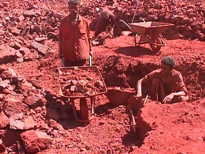
Mineral exploration

The minerals sector of the Egypt’s economy is an area of major significance and great promise, one that must be enhanced and expanded. Consequently, the Egyptian Geological Survey places considerable emphasis on its mineral exploration programs, using highly trained staff and modern techniques to explore for metallic and non-metallic (industrial) minerals, and drawing on the support and technical skill of a range of in-

house analytical laboratory facilities.

The primary goals of our mineral exploration programs are to explore and evaluate particular prospects or mineral belts and secure greater national self-sufficiency in resources. EGS also conducts pre-feasibility and feasibility studies of known deposits, whether the target commodity is a precious, strategic, or base metal, or a non-metallic resource. We also provide advisory and consultancy services for potential investors to evaluate the quality and quantity of resources at specific prospects.


Technical and resource information on mineral prospects is gathered using a variety of investigative techniques including geochemical and mineralogical sampling, drilling, trenching and geophysics. All new exploration data is entered into the EGS Mineral Occurrences Database, which is also being populated with historic data collected by EGS predecessor organizations


EGS Programs in Metallic Minerals


Survey and exploration by the EGS Metallic Minerals department is guided by a long-term Regional Reconnaissance program that identifies potential exploration targets based on documentary records, known ancient mining, and regional geological, geophysical and geochemical survey data. Targets are then followed up by more detailed surveys of individual prospects to determine potential resource value and attract potential investors. Analysis of ore samples is carried out by the EGS Chemical and Petrology Laborites.


EGS Programs in Industrial Minerals

Our industrial minerals team consists of experienced exploration geologists and engages in both EGS and community-funded projects throughout Egypt Exploration is supported by EGS drilling and field support teams and by the EGS Chemical and Industrial Mineral Applications laboratories.

Priorities for the EGS strategic program of exploration projects are formulated in response to statistics on national and regional mineral extraction, usage and anticipated needs, and in consultation with forums of key investors.

All new project data is added to the EGS Mineral Occurrences Database. Outputs are delivered as reports, maps and GIS. These products and databases are the source information for our advice and consultancy services, described below.

Services to the Community

The EGS Industrial Minerals Department offers an advisory and consulting service to investors by providing information on the location and availability of industrial minerals within Egypt, and by carrying out contracted exploration and evaluation projects. Three levels of service are offered:

1. Information and advice on known prospects based on existing information. The product consists of a short report, packaged with available published or open file reports, maps and data.
 
2. Field visits, carried out by experienced EGS staff, to demonstrate prospects on the ground to potential investors and carry out additional sampling as directed.
 
3. Resource evaluation projects to survey individual prospects, determine quality and quantity, and provide feasibility assessments for future mining operations. These projects are usually carried out in partnership with the EGS Mining Development Department.


 Mining Development

The objective of the EGS Mining Development program is to increase the contribution made by the Egyptian mining sector to the growth and diversification of the national economy, reduce reliance on imported raw materials, and encourage safe and environmentally sensitive development of mining operations in Egypt. We do this by:


Carrying out pre-feasibility studies of mineral resource locations using extensive drilling campaigns and ore processing tests in the laboratory and on-site


Advising on investment opportunities and market requirements for specific mineral commodities


Consulting on all aspects of exploitation methods and infrastructure, including mine waste management, environmental impacts and after-use options

Testing ores to refine processing methods and investigate new raw materials for industrial processes


Compiling and publishing national mining statistics for Egypt including information on mine locations and reserves, and on source, consumption and demand for each commodity.


Information Technology

The Information Revolution provides ever-growing opportunities to develop new tools and methodologies for geoscience surveys and research, new ways of handling, sharing and visualizing our data, and new ways of delivering knowledge and services to a global audience. In EGS, Information Technology underpins the management and publication of all our data and information, and is enhancing and diversifying the capability of all our geoscience programs, support services and administrative functions. In support of our geoscience programs, the main objectives of the Information Technology program are to:-

Compile, document and update geologic databases for mineral localities and drilling sites, and to archive sampling and analytical data for rock, soil and hydrogeologic investigations.


Establish a comprehensive digital database of geologic survey, exploration and applied geology data, and design and compile Geographic Information Systems for data analysis and delivery to customers.


Process satellite images and Thematic Mapper digital data for use by our survey, exploration and applied geology programs


Develop new systems and databases for primary digital recording of data by fieldworkers


Integrated Geoscience Database

Development and population of the EGS Integrated Geoscience Database is a major strategic project in EGS with the objective of digitally capturing, preserving and indexing the work of our predecessor organizations, and merging this with new, digital geoscience data collected by current EGS programs. The resulting database will serve future clients and programs of EGS with comprehensive and inter-operable digital geoscience data that can be visualized and delivered in a wide variety of user-specified formats and themes, and can be browsed and supplied to the community via electronic delivery

The Integrated Geoscience Database project has two main components:


Database development and management

Development and management of the Integrated Geoscience Database is emphasizing inter-operability of datasets to ensure wide application and exchange of information between the EGS and other organizations with similar interests, especially in management of groundwater, natural hazards, and mineral resources. Data structures are compatible with a variety of proprietary output software including GIS, statistical and borehole logging packages.

The database is managed using Microsoft SQL Server and built around a single relational data model with 12 interlinked domains and over 450 individual data tables. The domains reflect key applications of EGS information such as mineral occurrences, groundwater, and natural hazards, as well as survey activities such as mapping, drilling, geophysics, and chemical analyses. The principal domains are:

Geological Map Database
Geological Observations Database
Geophysical Survey Database
Geochemical Survey Databse
Water Resources Database
Seismology Database
Borehole and Drilling Database
Bibliographic Database
Mining Database
Geographic Information Systems

The EGS GIS department is responsible for digital capture and attribution of all maps produced by EGS survey and exploration programs. The department is well equipped with workstations running the latest ESRI ArcGIS 8 software. All new EGS printed maps are now produced by digital methods.

In addition to providing GIS data capture and digital map production services for current EGS projects, the department is also carrying out a number of strategic digitization and development projects.


 Development of an integrated GIS data model and database
 Digitization of existing geological and topographic maps
 Digital maps of Saudi Arabian administrative regions


Development of an integrated GIS data model and database


This project is developing an integrated, relational data model and database for future management and delivery of GIS data by EGS. The data model will standardize the basic attribution and symbolization of point, line and area features on EGS maps to ensure seamlessness of GIS data coverage for the entire Kingdom. Links will be created to other attributes tables that describe a wide range of geological, environmental and resource properties. The GIS database will be incorporated into the EGS Integrated Geoscience Database to unify all EGS geoscience data and information within a single data management system.


Digitization of existing geological and topographic maps

This ongoing project has the objective of systematically digitizing and attributing all existing printed geological and topographic map coverage of Egypt, with the aim of building an integrated and seamless national databank of digital mapping. Current work is concentrating on the 1:250,000 scale geological and topographic maps, and is being prioritized to ensure that digital map and GIS coverage of the more densely populated and resource-rich parts of Egypt is completed during the early stages of the project

Remote Sensing

Spectral imagery data covering the thermal-infrared, infrared, visible, ultraviolet, radar, and gamma -ray wavelengths, obtained by sensors mounted in aircraft or satellites, provide a unique perspective and information about the composition and structure of rocks and other materials exposed at the earth’s surface.  Remote sensing imagery is especially valuable as a geologic survey tool in sparsely populated arid areas, and its interpretation is therefore an indispensable step in all EGS geologic mapping, mineral reconnaissance and geohazard assessment projects.


Support for EGS programs

The Remote Sensing section offers services and training to EGS staff in the enhancement and interpretation of satellite data, and provides a range of hard-copy and digital products both for EGS internal project use and for external clients. Imagery is processed, enhanced and delivered using ERDAS 8.4 software.


Services to the community


EGS supplies remote sensing imagery mosaics to a wide client base in the government, industry, defense and education sectors.


Satellite imagery/maps can be delivered in a variety of paper sizes (A0, A1, A3, A4 or user defined) and types. Coated or glossy paper is more suited for posters and displays, whereas light coated paper is recommended for desk interpretation and fieldwork.


The Unit also offers training workshops for Earth Sciences students. The workshops familiarize trainees with the latest remote sensing technologies and provide practical exercises to demonstrate applications.


Publications and outreach

The EGS Publications department publishes the results of EGS programs, ensuring that these outputs are peer reviewed and edited to the highest scientific standards. It also manages the EGS library and maintains stocks of EGS maps, reports and books for external sale. Our main activities are:


Providing the technical and editorial support, including arrangement of peer review, to produce high quality geoscientific maps and reports in-house


Preparing educational and promotional material for publication and for conferences, exhibitions and seminars


Producing printed aerial photographs and topographic maps on stable and robust media for use by EGS fieldworkers


Managing the  EGS Central Library and Reference Archive, which holds the most complete catalogue of published and open file reports, maps and manuscripts produced by the predecessor organizations of EGS.

EGS Central Library and Archive

The Egyptian Geological Survey maintains a scientific, technical and professional Earth-Science library at the EGS Cairo office. It is one of the largest of its kind in Egypt and is an important source of published and on-line Earth-science information for EGS staff and visitors, the Government and private sectors, mining companies, Universities, and Research Centers.  It also houses archives of original field notes, manuscripts, and analytic data for EGS and earlier exploration and geologic projects.

The library contains a wide range of data and documents and a varied collection of geologic books and journals. The available materials are:
 Books
Technical and Open-File Reports
Geological, Geophysical, and Topographic Maps
Professional and Research Papers
Special Publications
Booklets, Pamphlets, and Brochures
Major international geoscientific journals
On-line bibliographic databases.


Maps

The Egyptian Geological Survey and its predecessor organizations have produced hundreds of geologic maps, at various scales, over the preceding 4 decades.  Most of these map products are for sale as hard-copy documents. A limited number of the newest map products can be obtained in digital formats.


The “GM map series” (Geologic Map Series) at 1:250,000 scale is the premier geologic map series of the EGS.  This is an ongoing series of color printed maps, with accompanying explanatory notes, that will eventually cover the entire Egypt.  The maps are 1 degree by 1.5 degree quadrangles, and conform to the 1:250,000-scale topographic map boundaries of the State..

In many cases, particularly in coverages of the GM-map products are compilations built on field mapping programs carried out at 1:100,000 scale.  Many of the 1:100,000-scale maps are available for purchase although, as base datasets, these maps are part of reports of varying size and complexity and are individually priced. 

In addition to the geologic maps available at 1:250,000 and 1:100,000 scales, EGS also has available a number of country-wide maps, shield-wide maps (at 1:1 million scale), and a range of specialized maps covering geology, aeromagnetic coverages, industrial minerals, etc.

Reports

The Egyptian Geological Survey (EGS) has produced several types of technical reports, which can be accessed through the following links:

  OPEN FILE REPORT

  TECHNICAL REPORT

 Training

EGS has an extensive range of training programs with emphasis on developing the geoscientific, information technology, managerial and English-language skills of its staff. Training comprises a combination of specific job-related courses, seminars and lectures, and participation in local and international conferences. EGS trainees also participate extensively in externally-provided courses on a part-time or time-release basis, and in geoscientific courses and seminars provided by staff from our partner organizations and other collaborators.


Laboratories and logistics

EGS maintains laboratory and logistical facilities to support its own survey and exploration programs and as services to external customers in the government, research and industry sectors.


EGS laboratories prepare and analyse rock, mineral, soil and water samples for a variety of downstream geoscientific, engineering and industrial applications. All our laboratories carry appropriate accreditation, and samples and analyses are prepared according to the applicable industry and research standards. Our laboratories are:

Chemical Laboratory
Water and Environment Laboratory
Petrology Laboratory
Industrial Applications Laboratory
Engineering Geology Laboratory


Chemical Laboratory

The EGS Chemical Laboratory carries out chemical analyses to provide baseline knowledge of the geochemistry of the rocks, soils and sediments of Saudi Arabia and its adjacent offshore territories. The analyses have applications for geologic mapping, metallic mineral exploration and the identification of sources and pathways for natural and man-made contamination of the environment.

hasan

hassan

  • Currently 191/5 Stars.
  • 1 2 3 4 5
63 تصويتات / 8129 مشاهدة
نشرت فى 12 مارس 2010 بواسطة hasan


The Second International Forum and Exhibition on

Economics Of Mineral Resources In The Arab World

Cairo-Egypt

23-25 February

2010

for more information

[email protected]

[email protected]

ses,[email protected]

[email protected]


hasan

hassan

  • Currently 183/5 Stars.
  • 1 2 3 4 5
62 تصويتات / 1164 مشاهدة
نشرت فى 3 نوفمبر 2009 بواسطة hasan

عدد زيارات الموقع

1,164,610